


 Forecast Summary
We are in the long-range forecast chart with this storm. We made this prediction back on November 9th, 24 days ago.

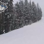
The storm is rolling through, right on schedule, With light snow in the northern Cascades, to heavy snow in the southern Cascades and Sierra. It reaches Utah late tonight and Colorado on Monday.
FutureSnow Subscription
We are launching our subscription service next week. I hope all of you will join us as we move into this next phase. We will continue to give you the best service that we can deliver. There is more to come on this, I will discuss that on Monday.
Forecast
Washington
Today
Looks like we’re not going to get skunked after all, expect a couple inches at Crystal Mountain, temperatures will be in the low 20s with moderate winds with gusts around 20 mph.
Monday and Tuesday will have little or no accumulation with the next storm arriving Wednesday night/Thursday morning. The next system will be much larger.
Oregon
Today
Expect 4 to 8 today for Mount Hood Meadows and Mount Hood Timberline, with 3-5 for Mt Bachelor. Temperatures will be in the lower 20s with moderate winds 10-15 with 20 mph gust.
Tonight/Monday
The storm moves out tonight, by 10 o’clock, but not before leaving another 2 to 4 inches for Mount Hood, with perhaps an inch or two for Mt Bachelor.
Monday expect bluebird skies and light winds with temperatures in the high 20s or low 30s.
Tahoe
 Winter Storm Warnings today until 4 am on Monday. Warm temperatures with a high of 31 today and snow levels around 4-6000 feet dropping this evening. Ridge top winds around 70-80 mph, which will likely close some upper mountain lifts.
Expect 8-12 for Kirkwood, Palisades, and Sierra at Tahoe, with 4-8 at Mt Rose, Heavenly, and Tahoe Donner, with higher totals with elevation.
Tonight
Colder temperatures tonight with lows in the 20’s and strong winds. Another 5-10 for Kirkwood, Palisades and Sierra at Tahoe, with 2-4 for Mt Rose, Heavenly and Donner.
Monday
Temperatures in the high 20s with light winds, for Tahoe standards, 10 to 15 mph. Expect another 4 to 8 for resorts along the crest.
Utah

The storm hits Tonight with decent temperatures in the upper teens to low 20s. I am expecting 4-8 before the lifts start turning on Monday morning.
Monday temps will be in the low 20s with moderate winds 10-15 mph. Snow totals Monday will be in the 4-8 range,
Colorado

This is a two wave system that, as you can see by the chart above, hits the northern mountains, then the second wave comes in from the southwest and moves northeast. All mountains are going to receive snow, when, is the question.
For the northern mountains,I am expecting 2 to 4 before the lift start turning, with another 3 to 5 throughout the day.The highest totals will be around Steamboat and Vail/Beavercreek.
For the southern mountains, Powderhorn, Telluride and Silverton, there won’t be much Monday, the action really begins Tuesday. I’m expecting storm totals in the 3-5 range.
This is a complex forecast, and I will be updating this page later today.
Thanks for reading the blog, as always if you have any questions, please ask in the comments below or send an email to Mike@FutureSnow.CO
 Forecasted Areas
Pacific Northwest Cascade Mountains
Crystal Mountain, Mount Hood Meadows, Timberline, 49 Degrees North, Bachelor, Mt Baker,
Lake Tahoe Sierra Mountains
Heavenly, Palisades Tahoe, Kirkwood, Dodge Ridge, Donner Ski Ranch
Utah Wasatch Mountains
Alta, Park City, Deer Valley, Brighton, Snowbird, Brian Head
Colorado Rocky Mountains
Aspen, Aspen Highlands, Snowmass, Vail, Beaver Creek, Winter Park, Keystone, Arapahoe Basin, Breckenridge, Copper Mountain, Powderhorn, Ski Cooper, Telluride, Crested Butte, Silverton, Wolf Creek, Eldora, Loveland
