
Summary
Rare bluebird skies today in Washington, while the Southern Cascades of Oregon, Sierras, Wasatch, and Colorado’s Rocky Mountains continue to get snow.
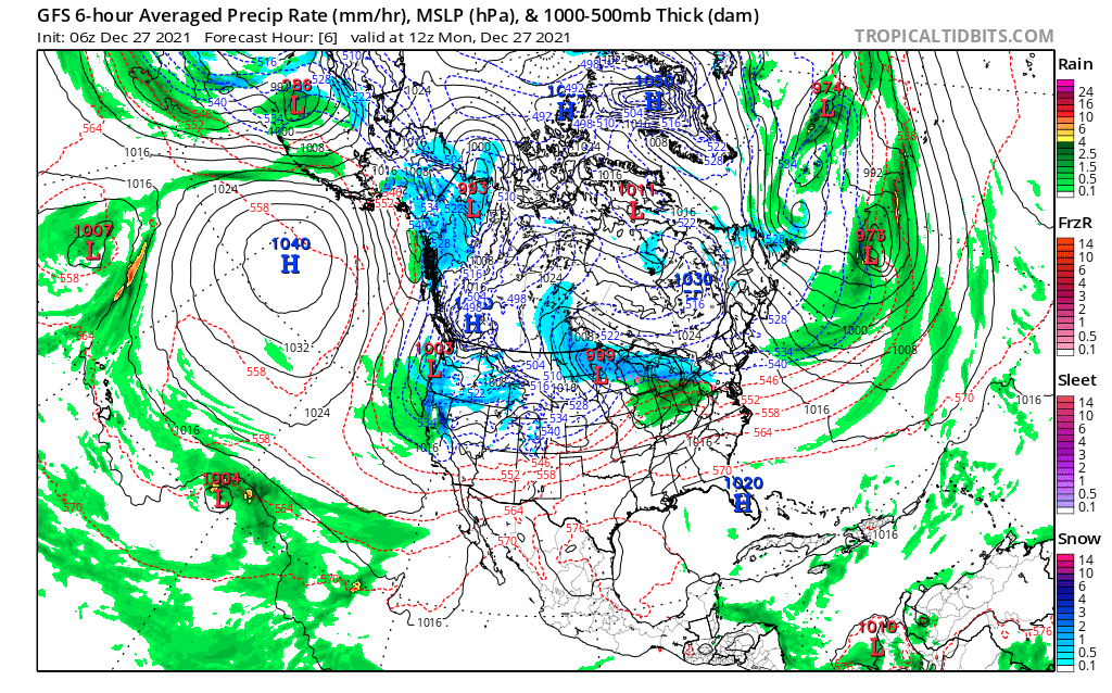
We are in the Active West part of the Pattern for 12 more days, then it flips to the Northern Part of the Pattern. The Northern Part of the Pattern lasts 24 days. The last time we were in that part of the Pattern, it was really dry in the continental United States, except for the northern part of the Pacific Northwest. Will it be dry again? I doubt it, but it won’t be nearly as stormy as it is now.
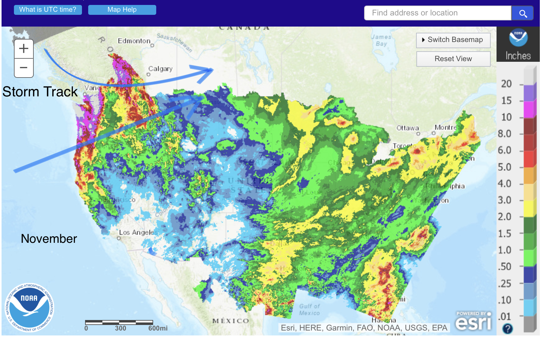
We have two strong systems left before the pattern flips. The first one is on New Year’s Eve, the second is a two-wave event that begins on January 4 and culminates January 7. We will go into further detail about those two storms below.
Stoke

Today
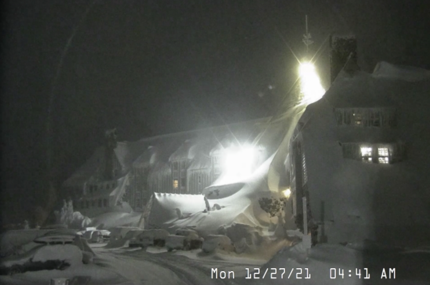
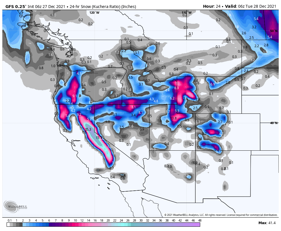
PNW
Northern Cascades: You guys are on break. Enjoy bluebird sky’s today and light winds. Maybe some orographic snow, but other than that, a great day to enjoy all of the powder from the last few days.
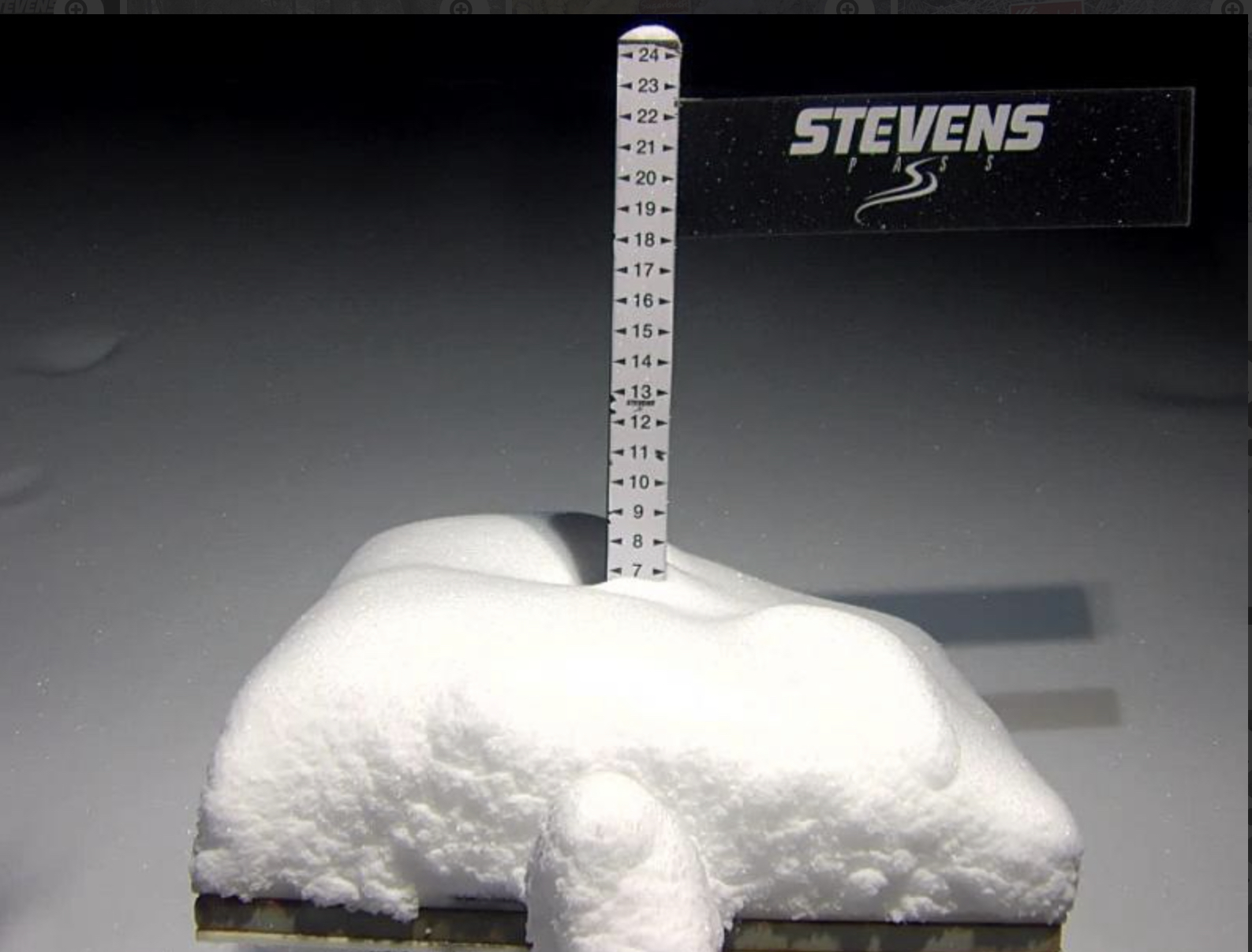
Southern Cascades: Light winds and not much snow today, as one system goes by, before another one arrives tonight. 2-6 tonight.
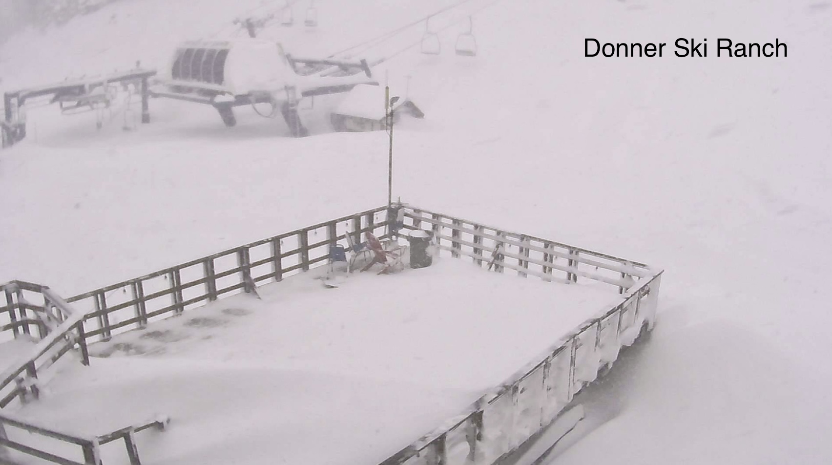
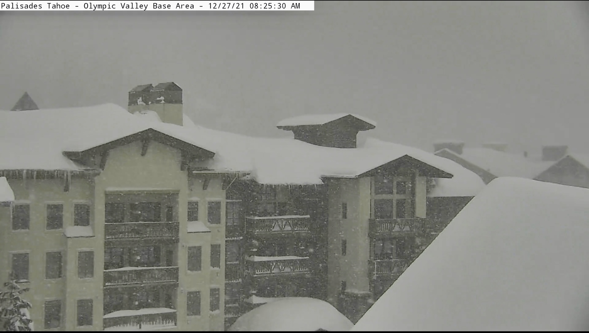
TAHOE
Snow with double digits to a couple of feet, for mountains around Kirkwood, up to Alpine Meadows and along the Crest. Farther north, on the south and west sides of the lake, around Heavenly and Homewood, will receive much less, between 6-10.
UTAH
Heavy snow and windy with 1-2 feet expected as the storm moves through today and exits overnight tonight.
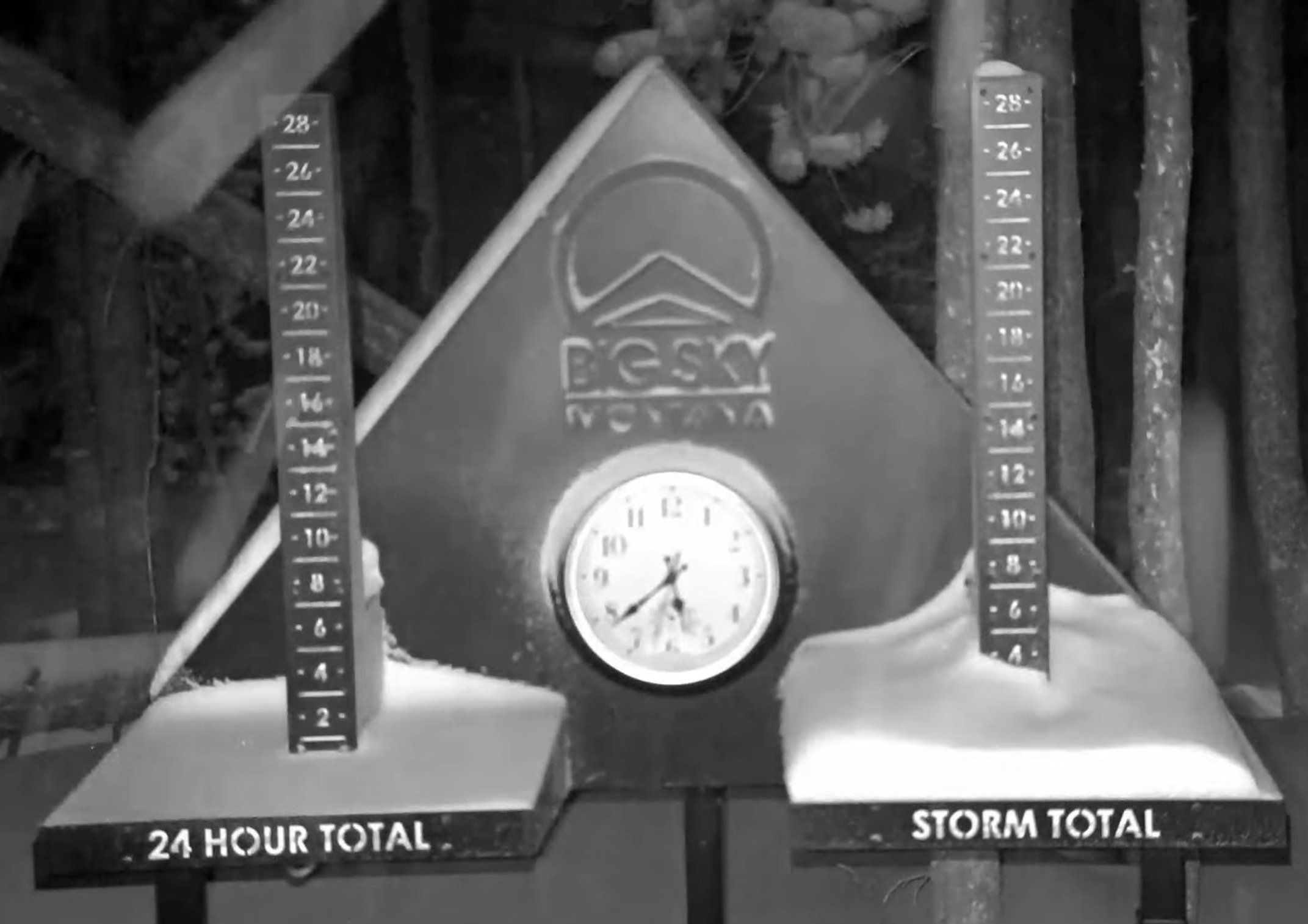
COLORADO
High winds today as the system moves in from Utah during the afternoon today. Snow will begin after midnight and should have 3-5 before lifts open tomorrow, with more snow expected for the central and northern mountains–4-8 range.
 n
nTOMORROW
PNW
Another 3-5 for the Southern Cascades with light winds.
TAHOE
A break between systems. Light winds and highs in the lower 20’s.
UTAH
Powder day! Chilly with cold windchills.
COLORADO
Snow ends by late morning for most mountains.
Next System
New Year’s Eve: This storm is the next to last storm in the Active West part of the Pattern. It arrives in the early morning hours in the PNW. Last time through it missed Tahoe (north) and was all rain except for Utah and Colorado. This time looks to be all snow with a similar track.
Last Storm Before Flip
Jan 4: This is the 2-wave system. First wave begins on day 37 of cycle 2. Second wave on day 40. The unique thing about these two distinct waves was that their track moved from the southwest to the northeast. It was a signal as to what was to come. We will be watching this storm closely, and the teleconnections, to see what the Northern part of the Pattern holds for us this time around.

Great work Mike! Any predictions for February yet?
They are coming out on tomorrows post. You can also use the calendars as well. They are under Resort the Forecasts tab.
I just posted the predictions under the predictions tab Aaron
Hopefully that northern tract still hits SW Montana with a west or NW flow.. you look to be right with the pattern flip because the models cant figure anything out right now beyond 10ish days..
Jan 5, 8, 13, 21,23, 25, are all possible dates in Jan. Jan 13 was huge for Revelstoke and Banff, just missed to the north–so circle that date and keep an eye on the models. The 3-wave storm (Trifecta) comes through Feb 7-10. That one hit in the first cycle (oct 13) and missed south in the second cycle. I bet it hits in cycle 3 because every other cycle is similar. It’s hard to explain but I’d bet it hits.
You will need to chase because Montana is a tricky location this pattern. Tell me where you plan to go and I’ll add it to my watch list.
My theory is that Colorado will probably at least see scraps during the northern parttern. Do you agree? I know we are prone to 10 day dry spells during mid winter though.