Snow Stake Cams


Forecast Summary

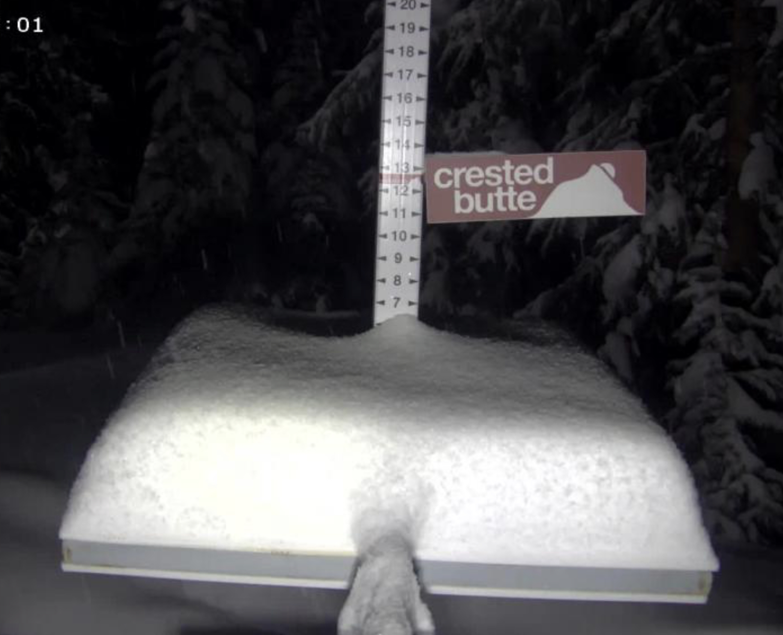
Heavy snow today in the Sierra and Wasatch as Winter Storm Warnings are in full effect. Multiple powder days for Tahoe, if you can get there (and resorts are open), and Utah as wave after wave moves through. Alta reporting 13, Deer Valley 19 and Park City 13. Colorado powder day today as another Steamboat Suprise and Crested Butte getting a fresh 6. I will have some pics tomorrow of the conditions at CB. BTW, sorry for the short blog yesterday, I was struggling with some connectivity issues.

Utah resorts will get a break in between waves by the afternoon, as the next wave is already moving into Tahoe around 6 am. This will bring the heaviest snowfall rates and falling temperatures due to the position of the trough, coming thru bringing an influx of cold air. This second wave reaches Utah resorts Tonight bringing heavy, cold snow for another powder day tomorrow.
Its piling up in Utah. We will be emphasizing our February predictions for Utah in the coming weeks, but before then, we have a few January storms left for Utah that we will break down once we have time to breathe.
Ok let’s back up and go back to the first wave for Colorado. This wave is already moving thru and surfing the crest of the trough. This is a pretty good system, overall, and for the southern mountains, which are catching up in the snow totals. Powder Day Manana.
Long-Range Predictions thru March
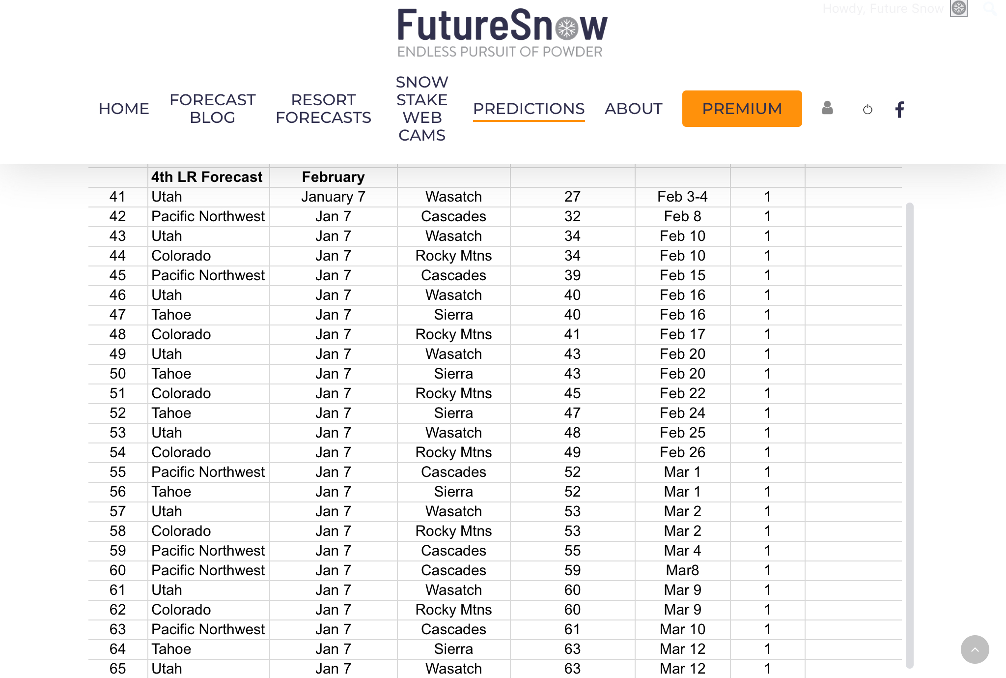 We have our long-range forecast out thru March, there have been a lot of emails regarding the long-range, and I thank you for your patience. Every year, it is very challenging to put all of this together.
We are getting better and better at figuring out the cycle, what the various teleconnections are, and how likely they are to affect the pattern. It’s a lot of calculating, analyzing charts, and waiting.
It is also very rewarding once you figure out what is going on. Sometimes you think you have it all figured out, only to realize you were wrong. It takes all of the aforementioned process and much more, that I won’t bore you with, but there it is.
As always you can email me with other resorts and areas you are interested in. We can forecast for the entire northern hemisphere, so if you are interested in the east coast resorts, Europe, or Canada, just let us know and we will give you a detailed forecast.
Forecast
Lake Tahoe

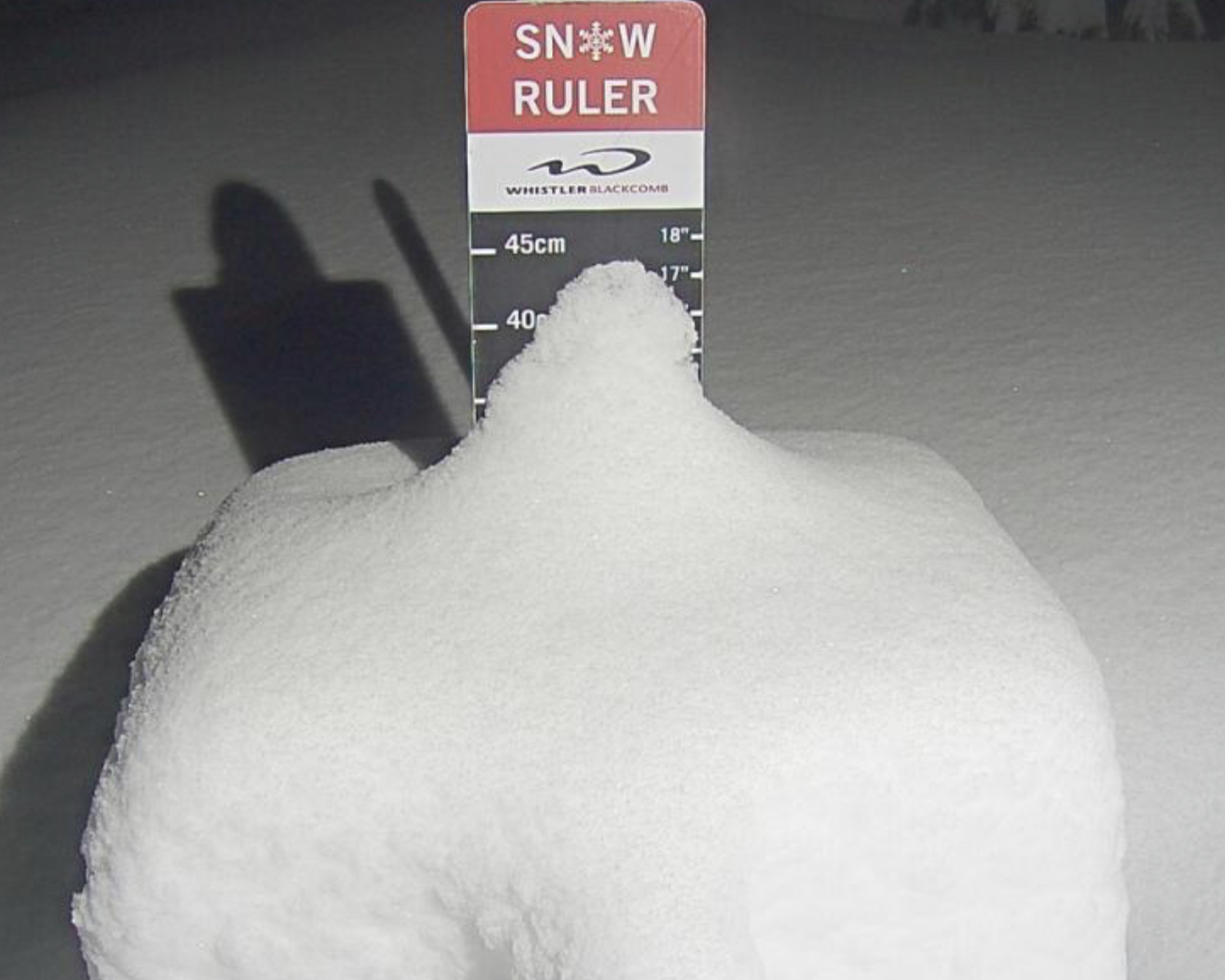
Winter Storm Warnings thru late tomorrow night as heavy snow throughout the day today and tonight. Temperatures falling throughout the day and will settle in the mid 20’s, as the incoming trough brings colder air. Strong winds with gusts around 50 mph at base level with ridgetop winds around 90 mph.
This storm exits tonight, with another small wave that will come thru tomorrow morning, around 10, adding a few more inches. Temperatures tomorrow around 30 with moderate winds with occasional gusts around 30 mph.
Next system Saturday

Utah

Winter Storm Warnings thru Wednesday. Another good round of snow today as there will be a small break in the action this afternoon, as the next wave approaches. Expect temperatures to be in the upper 20’s but there will be pretty cold wind chills, around 10 degrees. Winds will be strong, 20-30 mph with 40 mph gusts. Tonight, heavy snow and cold with temperatures in the lower teens by tomorrow morning.
Tomorrow
Snow, cold and moderate winds 15-20 mph with gusts around 25 mph. The storm exits around noon and scattered snow showers are possible thru the evening.
Wednesday thru Friday dry, then the next system arrives on Saturday.
Utah

Colorado


Today
Scattered snow showers are possible thru today with warm temperatures in the mid-30’s at base level. The storm is moving in from the west, southwest, so I am expecting snowfall to begin this late this afternoon or early evening along Grand Mesa, and the San Juans by 8 pm.
Tomorrow
Snow tomorrow throughout the day with strong winds with gusts up to 40 mph. The heaviest snow will fall in the southern San Juan mountains and all the way south to Taos New Mexico, as we are finally getting some better storm tracks for those areas.
Thursday thru Saturday mostly Dry, with temperatures in the high 20’s to low 30’s.
Next System Saturday Night
Forecasted Areas
Pacific Northwest Cascade Mountains
Crystal Mountain, Mount Hood Meadows, Timberline, 49 Degrees North, Bachelor, Mt Baker,
Lake Tahoe Sierra Mountains
Heavenly, Palisades Tahoe, Kirkwood, Dodge Ridge, Donner Ski Ranch
Utah Wasatch Mountains
Alta, Park City, Deer Valley, Brighton, Snowbird, Brian Head
Colorado Rocky Mountains
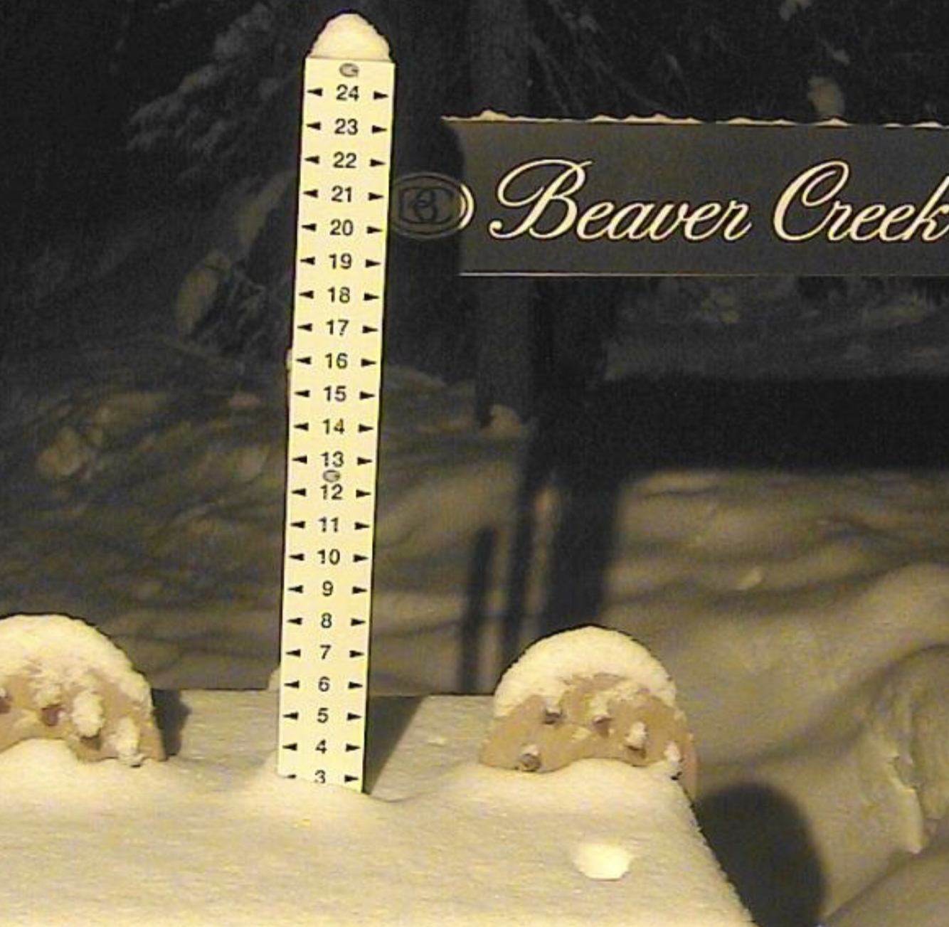
Aspen, Aspen Highlands, Snowmass, Vail, Beaver Creek, Winter Park, Keystone, Arapahoe Basin, Breckenridge, Copper Mountain, Powderhorn, Ski Cooper, Telluride, Crested Butte, Silverton, Wolf Creek, Eldora, Loveland
