Forecast Summary
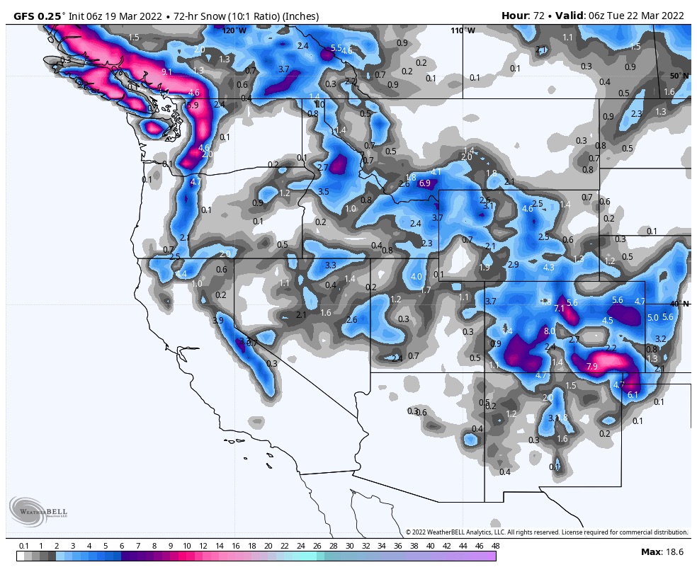
Snow continues today for the Pacific Northwest Cascade mountains. That system will slide down to Tahoe today and bring wet snow to the Lake. Tonight, the storm reaches Utah and by Sunday morning the snow will be heavy with cold temps. Finally, Colorado gets in on the action by Sunday night and Monday.
Welcome to Future Snow
If you are new to our site, you are in for a surprise. The weather repeats. Stay with me…..for the last 20 years, Gary Lezak, a meteorologist in my hometown of Kansas City, has been working on understanding how this all works and has authored a peer reviewed study called “Cycling Weather Patterns in the Northern Hemisphere“. Below is a video with two cycles synced up so you can see the pattern clearly.
That is a little background on what we call the Pattern. Once you understand it, you can predict weather months in advance–that is what we do here. Presently, we are about 87 percent accurate predicting storms over 30 days out. We have an official prediction chart posted with all of this years predicted storms and results.
Forecast
Pacific Northwest
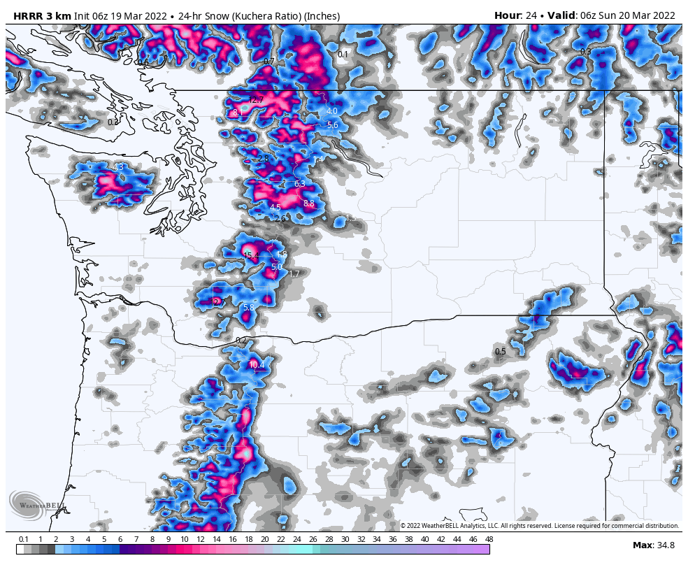
Snow continues today for the Cascades with an additional 2-4 today for Crystal Mountain and 6-10 for Mt Baker. In the southern Cascades, expect 5-9 for Mt Hood Timberline and Meadows with 3-5 for Mt Bachelor. Winds between 15-20 mph with falling temps in the afternoon, along with snow levels.
Sunday, a little colder with 6000 ft high temperature around freezing, that will be in the high 20’s for 8-10,000 ft range. Winds will be much better, in the 10-15 range.
Tahoe
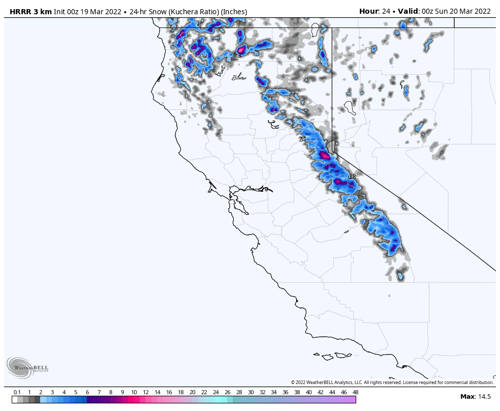
Another Warm storm for Tahoe today as the system slides down the coast early this morning. I am expecting the precipitation to begin by late-morning. 5000 ft temps around the freezing mark with strong winds with 35 mph gusts. Mountain top gust will be very strong so that could delay some operations. Snow totals for Kirkwood, Palisades and Donner Ski Ranch in the 4-8 range, with lower elevation resorts like Mt Rose in the 1-3 range.
Utah
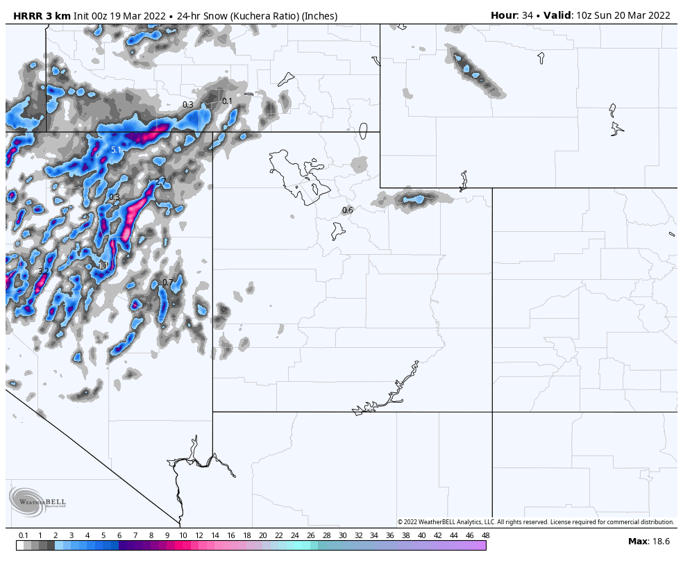
It will be a nice day today with a high of 38 (6500 ft). Snow begins tonight, after the lifts close, at Alta, Brighton and Snowbird with 1-3 by morning. Sunday the winds will ramp up, as will the snowfall rates. Expect heavy snow throughout the day with 6-10 by evening. Sunday night the system departs.
Colorado
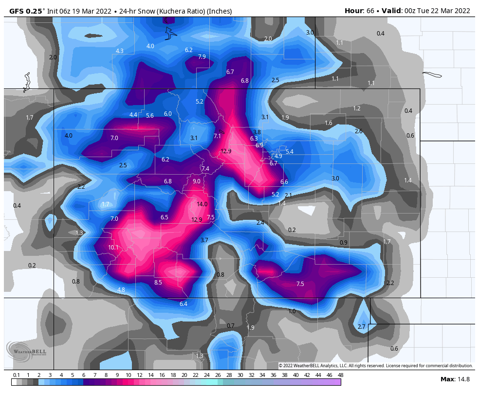
Bluebird skies today and partly cloudy tomorrow before the storm approaches Sunday night. Good time to get out the sleds, or uphill before the storm moves in Sunday night. Expect 1-2 before the lifts open Monday at Vail, Crested Butte and Telluride with less around the wests Grand Mesa. We will go into more detail as the system gets a little closer.
Long Range Forecast
This is a reprint of our prior spring break forecast back in mid-February and it has been spot on. All of the predicted storms have been there and on time. You can scroll thru and see the upcoming storms, we have just talked about.
Finally, the long-range predictions thru mid-April are last. Thanks for reading the blog, if you have any questions feel free to comment in the comments below or send an email to Mike@FutureSnow.co
Spring Break Forecast for March
March 13-19
We are split again during these dates. The only consensus is Colorado on days 42-43 (Mar 19-20). This was a small storm in both cycles with Colorado resorts picking up between 6-12, on average, in both cycles.
If the strength of the Pattern mirrors cycle 1, then Alta, Snowbird and Park City all received snow on day 41, which is March 18th.
March 20-26
During this week, in both cycles, we had a storm on day 43 (March 20), same storm as above, in Colorado (Nov 12, Jan 15). Both storms were on the mild side with Breckenridge getting 11 in cycle 1 and Aspen and Steamboat receiving 3 in cycle 2. Another small wave came through on day 49 (Mar 26) with snow totals between 3-4 for Breckenridge, Alta and Snowbird.
March 27-31
On days 52-54 (Mar 29-31), depending on which cycle, there was a storm that came through Colorado and Utah. Minor totals in both cycles for Utah, from 3 in cycle 1, to just an inch in cycle 2. Colorado ranged from 2-4 for most mountains in Cycle 2, to 6-9 for most mountains in cycle 1. I am expecting this to be more like Cycle 1 this time thru due to the strength of the jet stream this time of year.
All Pattern Storms thru Mid-April
Place, Date of Prediction, Mountains, Lead Time, Date Predicted, Cycle day
| Colorado | 1-March | Northern Mountains | 18 | Mar 19-20 | 42-43 | 1 |
| Revelstoke, Banff | 1-March | Selkirk, Alberta Range | 21 | Mar 22-23 | 45-46 | 1 |
| Jay Peak | 1-March | Vermont | 23 | Mar 24-25 | 47-48 | 1 |
| Colorado | 1-March | Colorado | 28 | Mar 29-30 | 52-53 | 1 |
| Colorado | 1-March | Colorado | 31 | 2-Apr | 56 | 1 |
| Colorado | 1-March | Colorado | 41 | Apr 16-18 | 6-7- | 1 |
