Resort Openings Announced
Vail, Mt Rose, Dodge Ridge, Timberline Mt Hood is open.
Kirkwood, Heavenly. Saturday (11/12)
Park City Nov 16.
Palisades Nov 18
Crystal Mountain for pass holder’s 18th.
Aspen Snowmass Nov 19
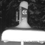


Great storm for the west. Well, most of the west, Colorado was on the low side of the snow. Generally, 4 to 6 inches for most resorts with a 1-day event.
The Pacific Northwest ranged between 2-3 feet. Lake Tahoe resorts around 3 feet, with the exception of Homewood, which received 3 feet in one day, with over 4 feet for the storm. Utah resorts notched 3-4 feet.
The storm had three atmospheric river events (AR) in this amplified pattern. Hopefully, the next time this storm rolls around, we are in an amplified pattern as well. We will keep an eye on the teleconnections to see if they lineup as the storm returns.
Like I mentioned in the last blog post, we are coming up on a less active stretch of the pattern. It’s not too bad, there will be a couple of small systems coming through that should give Utah and Colorado resorts a refresh on November 15th. Then another round a couple of days later on November 17-18.
Thanksgiving Week (reprint from last blog)
There will be a storm that will impact Montana and Wyoming right around Thanksgiving. The problem with this storm is it’s small. When it came thru in August, it was tiny. In October it was tripled in size but still small. What will it do this time?
I would love to place this storm on our forecast, but I can’t do it. So, I will monitor this storm and wait for it on the GFS. I’m sure it will be there, and I hope it is bigger and includes Colorado.
December 5th
I received 11 emails about this date from last post. No, it’s not a mistake, it was a tease about what is to come. The 18th of November to December 5th is a dry stretch, with the exception of Montana and possibly Colorado. The last two cycles there wasn’t much during this period. There was the wave I spoke about above, that got bigger from cycle 0 to cycle 1. Then a Canadian slider will hit around Dec 3rd. When you see a fast-moving system slide thru Whistler, Reve, and Banff the storms are getting ready to fire up. That begins on the 5th.
Where is the snow during this dry stretch?
System after system will pound the Gulf of Alaska. It is kind of like last year’s northern pattern, except its way north this year. Now the pattern is still evolving, there could be a chance storms could move further south. Especially in an amplified pattern, with the jet stream at its peak and if the teleconnections line up.
There is hope, then, for Canadian resorts and perhaps areas as far south as Montana. This stretch coming up, the 18th thru the 5th, will tell us what will happen in late January and early February.
Thanks for reading the blog! Mike
Test Prediction Chart

Pacific Northwest Cascade Mountains
Crystal Mountain, Mount Hood Meadows, Timberline, 49 Degrees North, Bachelor, Mt Baker,
Lake Tahoe Sierra Mountains
Heavenly, Palisades Tahoe, Kirkwood, Dodge Ridge, Donner Ski Ranch
Utah Wasatch Mountains
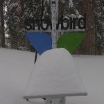
Alta, Park City, Deer Valley, Brighton, Snowbird, Brian Head
Colorado Rocky Mountains
Aspen, Aspen Highlands, Snowmass, Vail, Beaver Creek, Winter Park, Keystone, Arapahoe Basin, Breckenridge, Copper Mountain, Powderhorn, Ski Cooper, Telluride, Crested Butte, Silverton, Wolf Creek, Eldora, Loveland

Thanks Mike!
The storm cleared out of CA on the morning of Nov 9. It seems we could be looking at a 25-30 day dry spell if the Cycle doesn’t favor us until after Dec 5.
That may happen. There are small chances between now and then, such as this weekend’s (Saturday) system, looks like 1-3 as of now. The storm on the 18th might clip Tahoe. Basically, Tahoe has 3 big storms in 18 days. Maybe a 4th storm, after the first storm when the active stretch for Tahoe refires, it just missed to the north last time thru. Last possible chance would be November 30th. Sometimes the pattern flips, meaning a ridge becomes a trough. That could change things too.
So Whistler should be good first week of December?
There will be a storm beginning Friday December 4th. The best days should be the 5-6th. The following week Dec 8-9th are good. These systems could be stronger than last cycle because of a stronger jet stream. Also, give or take a day–the storms aren’t exactly on time.