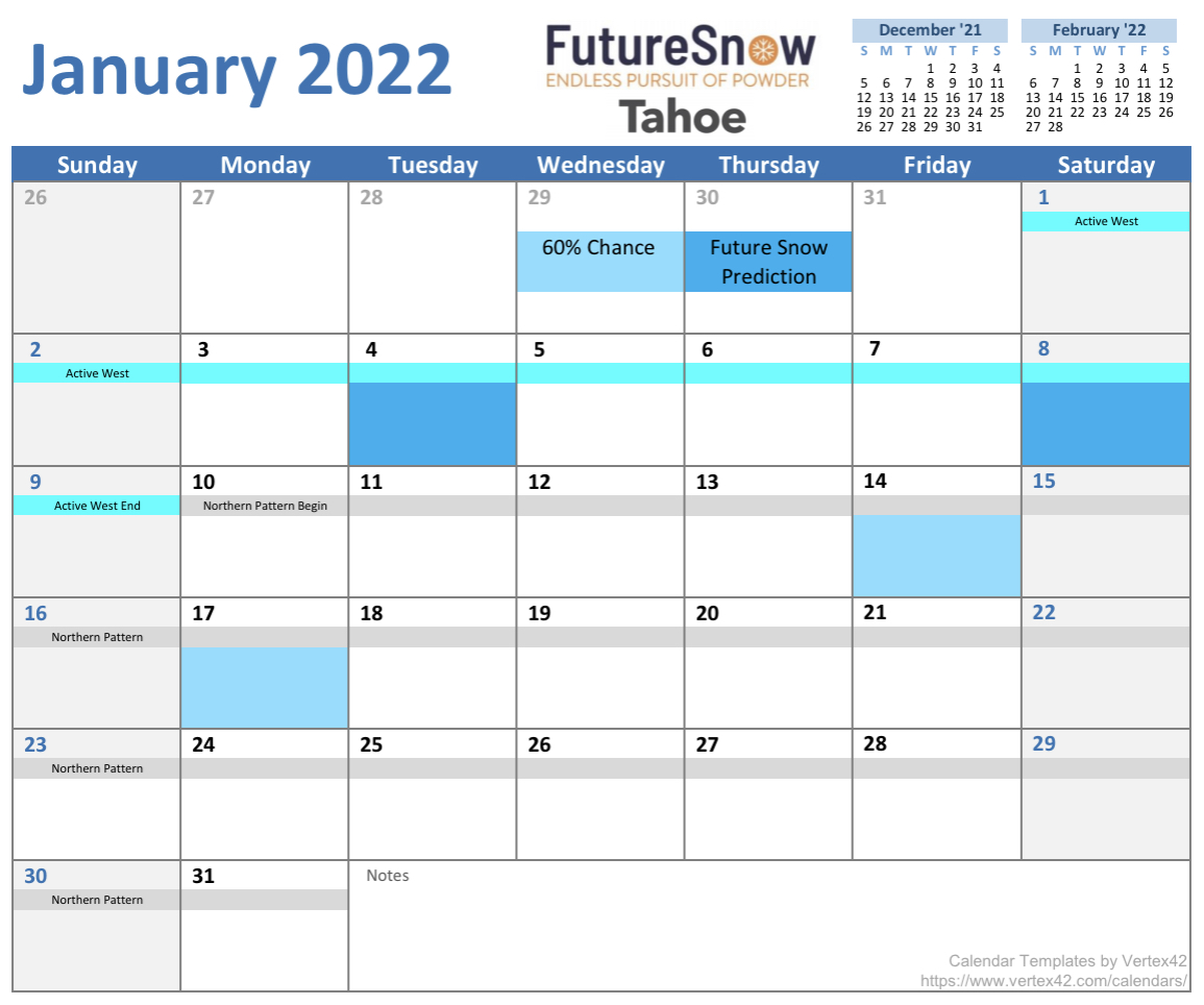
Tahoe Calendar
Tahoe calendar is out through April. This calendar took extra time to finish because the Tahoe region is really tricky to forecast. First, they get half of their snow from atmospheric river (AR) events. Second, they were on the edge of storm systems in the pre-cycle. Meaning they were missed all together or were grazed by systems on this year’s path. Once we got into the cycle 2, it was clear that the stronger Jetstream brought those storms into range.
There will be some finetuning as we go through the next few weeks as we wrap cycle 2’s Active West and move into the Northern Part of the Pattern.
Calendar Key
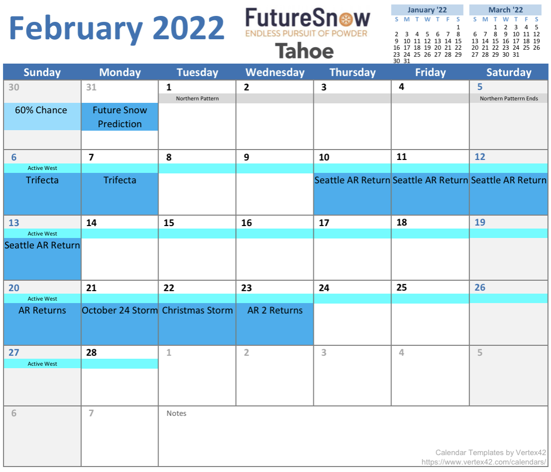
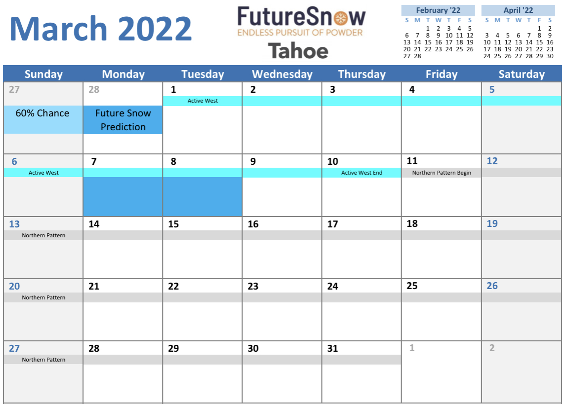
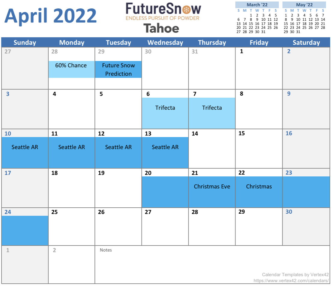
Dark blue = verified storms for 2 cycles. 80% chance of return (I will add detail soon, such as snowfall amounts from previous cycles).
Light blue = verified once. 60% chance of return. If these storms return, they will be elevated in cycle 3.
Active West and Northern Part of the Pattern are listed to show their timeline. During Active West the storms are stronger. During the Northern Part of the Pattern storms are stronger in Canada and the PNW.
Today
 PNW
PNW

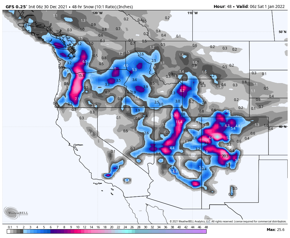
Snow today in the northern Cascades as a system kicked into gear overnight. The high temperature today will be around 17 with wind chills below 0 to -14. Winds steady throughout the day with gusts near 30 mph. Freezing levels from 0 rising to 10000 feet during the day. Total snowfall between 6-10.
Snow in the southern Cascades as the system moved into Oregon a few hours behind the north. Remember, this storm takes an angled path to Colorado as the track is morphing into the Northern Part of the Pattern, but we have one more system after this one before the switch is in place. Total snowfall for the day is 4-6 for most areas with an additional 5-9 by tomorrow morning before the lifts open. Temps, and wind similar.
Tahoe
Bluebird skies with light winds. Get out and play.
Utah
Snow today as the wave from the southwest arrived overnight. High near 20 today with windchills in the single digits. 5-8 by this evening. Storm intensifies as the southwest flow combines with the storm from the PNW. Powder Day tomorrow with 1-2 feet expected.
Colorado

Winter Storm Warning for Colorado! Snow moves in today as the southwest flow arrives. Most mountains will receive between 1-4 during the day with 4-8 overnight. More is expected for the central mountains which continue to be favored with this pattern 10-15 possible.
Tomorrow
PNW
Northern Cascades storm wraps in the early morning with 2-4 more to top off as the system moves out. Southern Cascades storm wraps up in the morning with another 2-5 before exiting. Cold temps and still breezy with gusts around 30 mph with winds dying down after the storm passes.
Tahoe
Rince and repeat: Bluebird skies with light winds. Get out and play.
Utah
Powder Day! Additional 2-4 during the day and possibly another 3-4 overnight before the system moves on to Colorado.
Colorado
Snow and steady winds and gusts over 30 mph. Additional 4-8 expected for all mountains.

Do you have any keys with the map to show what these predictions mean?
There are 2 shades of blue for the predictions map. Blue and light blue. Blue indicates strong probability (80%+) of a storm that has verified in 2 cycles. Light blue came through once and missed north or south, but was in the area.
Hi Mike,
I love what you are doing with these long term predictions, and I agree that the Tahoe region is challenging. We are not off to a good start with the January predictions for Tahoe, zero to 4 inches around the JAN 04, and most likely even less this weekend around JAN 08. The timing was definitely right, but the storm track was just a little too far north for Tahoe.
Keep up the great work, and I’m hoping that you can figure out how to fine tune the Tahoe predictions.