Posted July 7, 2023
Welcome to July!
I hope everyone had a good holiday! We are in a summer pattern where the jet stream has retreated deep into Canada. These next two videos show the circulation, first across North America, second, across the northern hemisphere.
This northern flow will continue through August before it begins to drop in September. The old pattern will continue until around August. The new pattern will slowly transition–It will likely be in the 50-60 day range.
El Nino Pattern

Last year, back in October, you saw the pattern flip to an El Nino like pattern, although it took about 6 months to warm the ocean water. The jet stream behaved like it was on steroids, dropping 900 inches in Utah resorts and over 700 inches in Lake Tahoe. It doesn’t take a genius to assume that Tahoe and Utah won’t receive that much snow this year, but I will say that it is likely that Utah and Colorado will be above average this coming season.
In fact, based on the multi-year pattern, it looks like Colorado will be the sweet spot this year, in terms of above average snowfall. I will know, for sure, once we get to October. At that time, we will have our first snowfall predictions for the season.

Hurricane Forecast
We are coming up on our early possibilities for Hurricanes. Below is our official forecast dates, but remember that these systems can hit a cycle early. I have placed the earlier dates in parenthesis below.
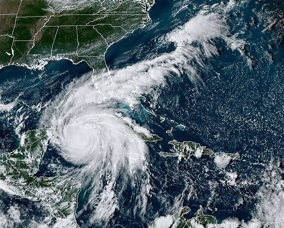
Hurricane Ian
This hurricane season will have 3-4 landfall events, with a total of 7-9 hurricanes. Florida will likely be hit again. Other possibilities are in the Gulf of Mexico and a Pacific storm–the Pacific storm areas to watch are between central to northern Mexico, including the possibility of San Diego, which rarely gets hurricanes.
 I haven’t ruled out a hurricane for Hawaii, it looked like it was possible as the pattern was setting up last year, however, there were no follow up indicators. Above is a gif of a couple of tropical storms heading towards Hawaii. If Hawaii is going to get hit, it will take a lower path, about 500 miles further south than the second storm.
Florida August 30-September 6th (July 12-19)
This storm will come through Cuba, Puerto Rico or both hitting the eastern coast of Florida. It will then move north Northeast through the Carolinas and farther up the east coast exiting around Maine.
Sept 6-7th Louisiana (July 19-20)
This storm is kind of either/or situation. If the above storm doesn’t hit Florida, it could take an alternate path, south of Florida, to Louisiana. Florida (above storm) is the most likely location. There is a possibility of this storm originating in the Gulf and moving East hitting the West Coast of Florida, but that is unlikely.
Yucatan Peninsula South to Honduras Sept 30 to October 3rd (Aug 12-15)
Watch out Cancun travelers. This storm will originate in the Caribbean Sea and move west.
Pacific Storm Sept 30 to October 5th (Possibly 1 cycle earlier, August 12-17th)
This storm will originate of the South American west coast and move north northwest, likely west of Baja California, turning northeast around San Diego.
Thanks for reading, as always, if you have any questions, please email me at Mike@FutureSnow.CO
Video of the LRC Cycle Comparison 22-23
Thanks for reading the blog! If you have any questions feel free to comment below or email me at Mike@FutureSnow.co
