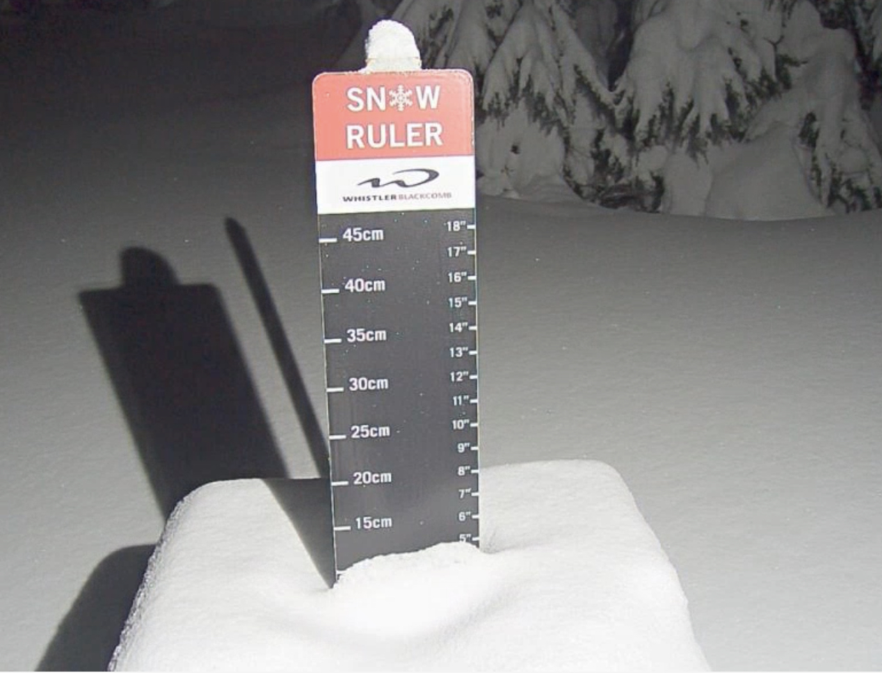
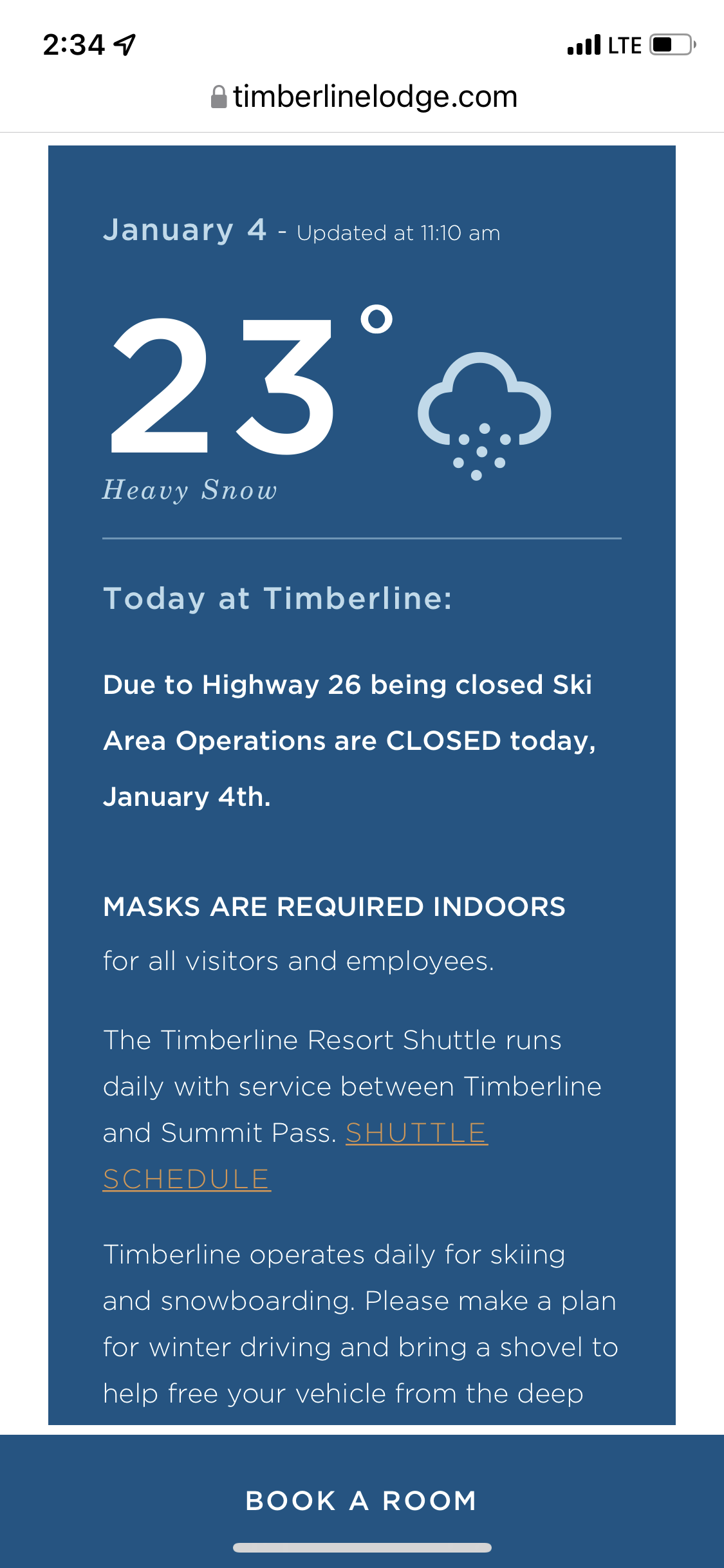
Resort Status (Powder Day Today due to Closure)

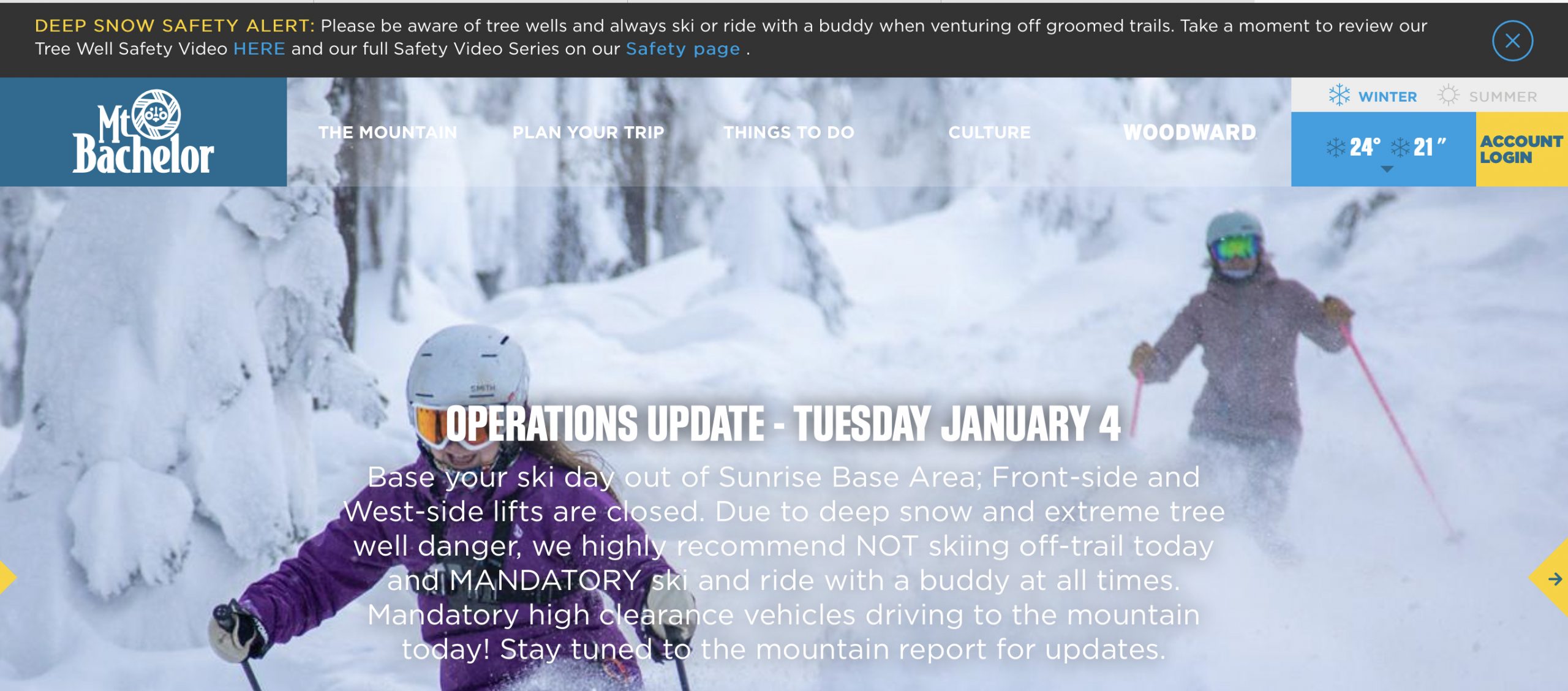
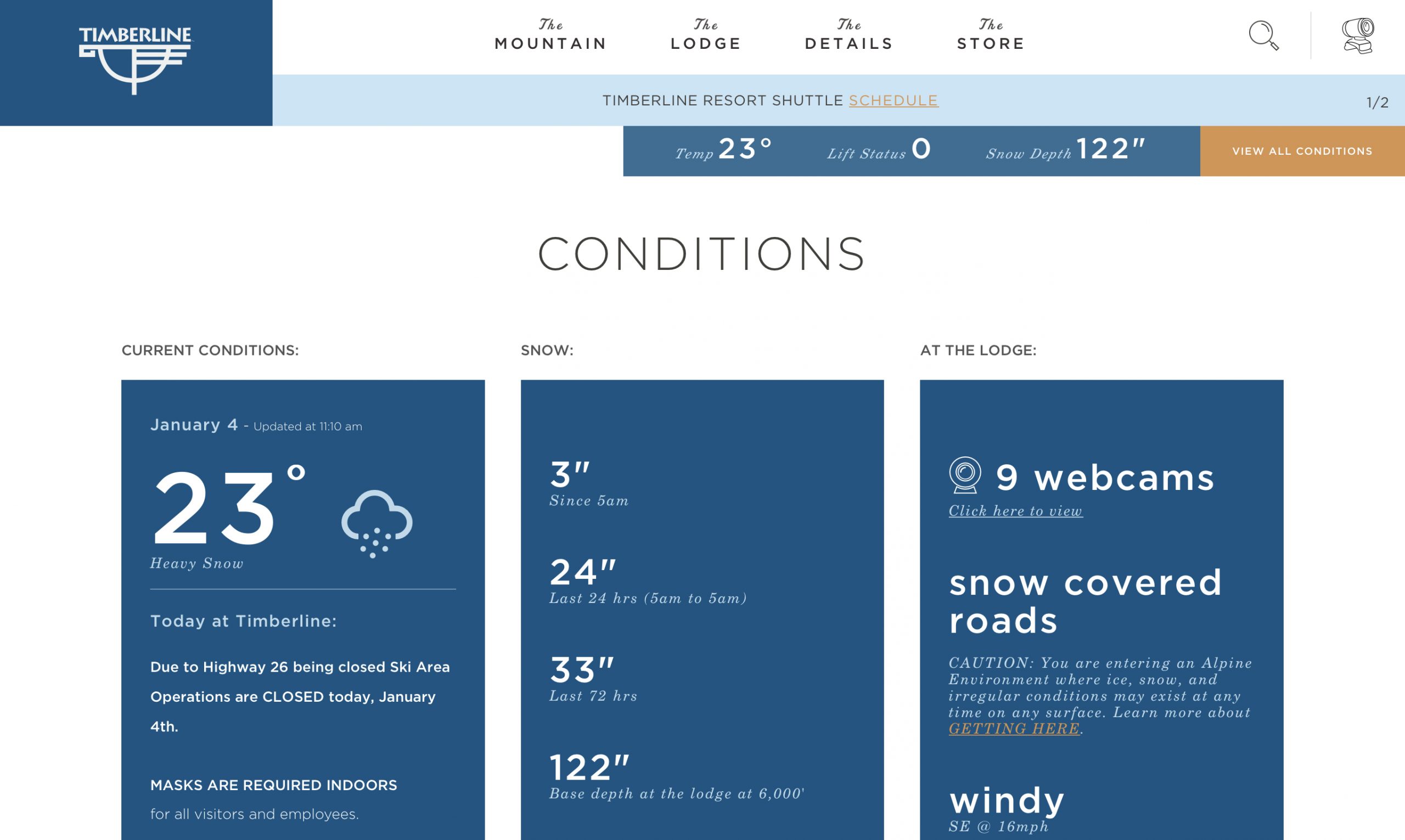
Oregon resorts Mt Bachelor, Timberline and Mt Hood Meadows closed yesterday, due to road closures and safety issues. Make sure you check the Resort website before you depart in the morning. With all of the recent snow, be extra careful going into the backcountry and be aware of tree well danger.
Summary (click to animate)
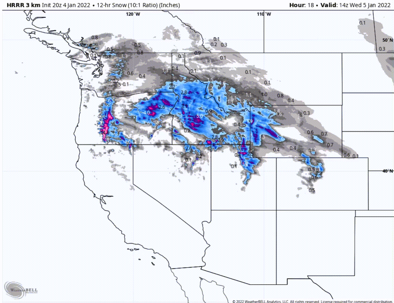
A small break in the action for the northern Cascades as the next system hits the coast. Southern Cascades reloads as a wave of energy works from Oregon, north to Washington. Meanwhile, Utah and Colorado get underway today, as the departed system from the Cascades hits the Wasatch and Rockies.
Stoke
Pattern Discussion
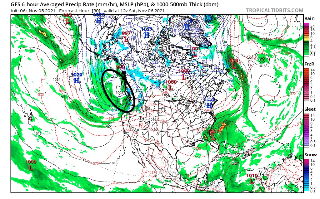
Day 38 of cycle 2. Last time through this is how the GFS 6-hour MSLP map compares to the present map. Unfortunately for Tahoe, it is taking the same track as last time. I expected this storm to be a little stronger, but to quote Yoda “there will be another”. That storm actually connects with the present storm Saturday, just like it did last time, and last time Palisades got rain and 7″ at their 8000 ft snow stake location (Nov 9th). Let’s keep an eye on this storm for Tahoe because its slim Pickens, for them, during the Northern Part of the Pattern.
Cycle 1
Cycle 2
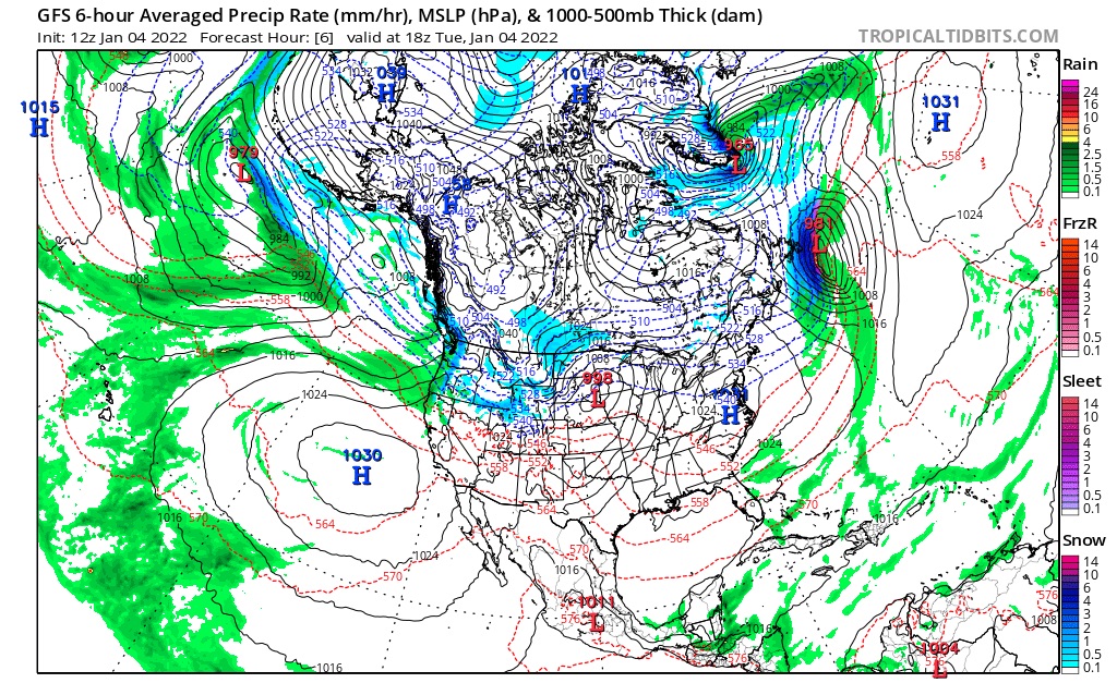
Today
PNW
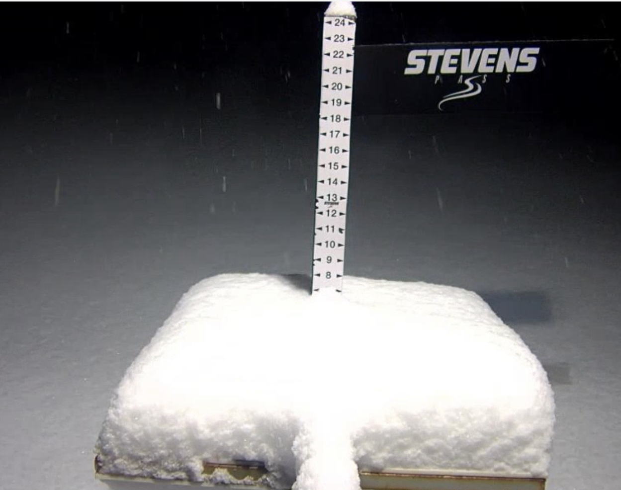
Northern Cascades get your warm wax on today. Snow in the afternoon with “decent” temps today with highs in the mid 20’s. Freezing levels around 4000 ft. Crystal Mountain has a base around 5000 ft so should be good today. Stevens Pass and 49 Degrees North is around 4000 ft, so a little soupy possibly at the base. Total snowfall expected 10-15″ for Crystal and Stevens mostly after the lifts close. Less for the northern mountains. 49 Degrees North 4-6.
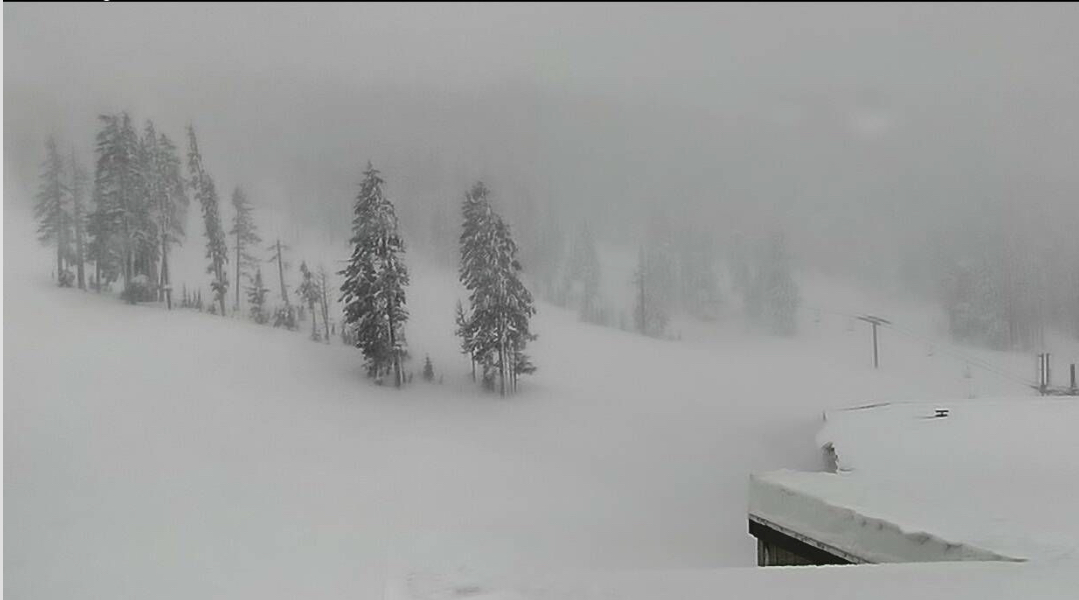
Southern Cascades Winter Storm Warning, again, heavy snow with moderate winds. Temperatures in the upper 20’s at the base and lower 20’s up top. Ski laps off the Cascade Express (Mt Hood Meadows) and hit the Super Bowl. If you’re at Bachelor it’s the Summit Chair, but you guys already know this! MAKE SURE THEY ARE OPEN FIRST!
Utah
Winter Storm Warning until Thursday. Heavy snow with Temps in the lower 20’s. Windy with gusts in the 40’s–Yikes! Snowfall totals between 1-2 ft.
Colorado
Winter Storm Warning for areas north of I-70, with snow and high winds with gusts in the middle 40’s. 4-8 expected throughout the day and another 5-10 overnight, before the lifts open. tomorrow. Central mountains, like Crested Butte, expect 4-8. Not much for the southern mountains, 1-3 inches–maybe.
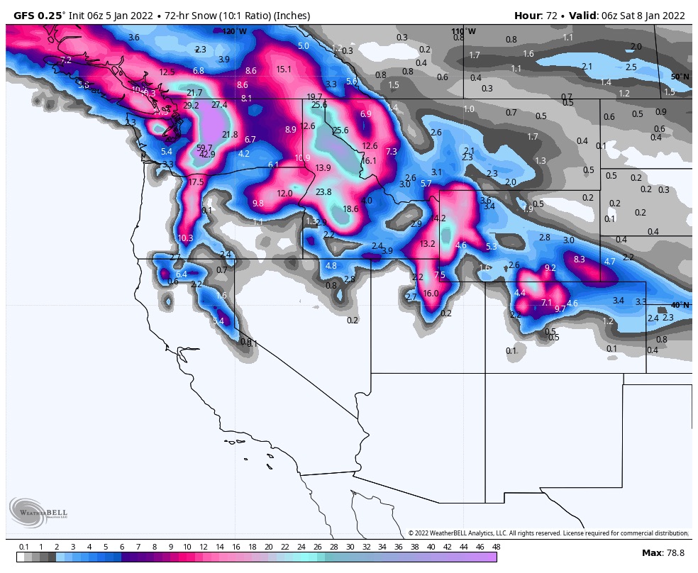
Tomorrow
PNW
Northern Cascades All snow for most mountains with high temps, in the lower 30s at 4500ft. Accumulations of 1-2 ft of Cascade Concrete.
Southern Cascades Heavy snow with rising temps and snow levels. Snow level could rise to 7500 ft but will fall back to 4500 ft in the afternoon. This is a tricky forecast because of these temps, but I will say expect 6-10 over 6000 ft.
Utah
System moves out during the morning hours but should be a stellar powder day, with 6-10 from the overnight before the lifts open.
Colorado
Snow in the morning as the system moves out. Still windy with 35 mph gusts and temps around 30 at 7000 ft.
Next Pattern Storm (Prediction Chart)
Jan 6-8 PNW: GFS on track and on time
Jan 8 Colorado: GFS on track and on time

Mike,
How does the upcoming ridge over the west line up with the last pattern??
Sorry I didn’t see this, James. The ridge does line up. Thats one of the aspects of the Northern Pattern. I am working on a video of this years pattern that will show how the ridges and troughs line up.