Posted May 3, 6:39 am MT 5:39 PT


 MSLP Surface Chart thru May 12
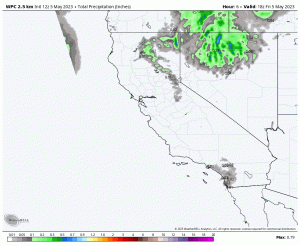
High Resolution and Total Precipitation (click to animate)
Forecast Discussion
Snow continues in the Pacific Northwest down to the Sierra today, thru at least Monday, as this wet weather pattern and cold temperatures continue. Snow levels drop below 4000 for the Cascades and 5000 for the Sierra overnight tonight. Cascade snow totals in the 1-2 inch range thru Sunday.
For Lake Tahoe, the next wave of snow moves in around 11 or noon, bringing light snow. Heavy snow, at times, after midnight tonight, through the day Saturday tapering off in the afternoon. I am expecting 3-6 before first chair and another 3-6 throughout the day. Temps today will reach 37 at Lake level and drop to 26 by 6 am tomorrow morning. Winds will mild today, between 10-15 mph. Tomorrow similar wind but add gusts, around 25 mph, with ridgetop gusts near 40 mph.
Over to Utah, colder temperatures have settled in with a few inches on the snow stake at Alta. Banff type weather, the next few days, as 1-3 inches are possible today and tomorrow. 6500 feet high temperature will be 37, with the low tonight around 25. Similar temps tomorrow. Moderate winds today with light winds tomorrow.
In Colorado, the day starts out sunny but clouds and possible snow shower this afternoon. Light winds and warm with Breckenridge high temperatures around 50, and Arapahoe Basin base level around 40. Tomorrow, scattered snow showers with 1-2 possible, slightly cooler temps with moderate winds 15-20 mph with gusts around 40.
Colorado Next Thursday Still on Track! Remember May 21st Last Year
Possible Big Storm
 We are tracking a system, on the GFS, for Colorado that is pretty large, especially for this time of year. Right now, it looks to dump a foot of snow in spots. So, how does this storm fall in line with the pattern, let’s dive in and break it down.
These next 5 charts are from each cycle through the last chart that is projected for May 11th. I am showing you these charts because all of them show a trough that will allow cold Canadian air, which is essential this time of year.
The projected chart most resembles the chart from December 14th. During that cycle, Wolf Creek received 3 feet over 3 days, with Aspen 15 and Steamboat 11. Arapah0e Basin is in the best position for the coldest air so I am hoping we have a storm like last year’s May storm that dumped 16 inches on May 21st. Will history repeat itself? Let’s hope.
 This storm did not hit in all cycles. It missed in cycle 3 for both Utah and Colorado. Looking at the May Calendar for A-Basin, you can see the 60% chance on the 11th and the 30% chance for the 12th.
The 12th is not the only chance for good snow. Looking at the calendar, the 9th is on the GFS at well, that also could bring good totals for next Tuesday.
Open Resorts
California
Palisades, Heavenly, Mammoth
Utah
Snowbird, Solitude and Park City
Colorado
Breckenridge, Arapahoe Basin, Copper Mountain, Winter Park
Forecasted Areas
Pacific Northwest Cascade Mountains
Crystal Mountain, Mount Hood Meadows, Timberline, 49 Degrees North, Bachelor, Mt Baker,
Lake Tahoe Sierra Mountains
Heavenly, Palisades Tahoe, Kirkwood, Dodge Ridge, Donner Ski Ranch
Utah Wasatch Mountains
Alta, Park City, Deer Valley, Brighton, Snowbird, Brian Head
Colorado Rocky Mountains
Aspen, Aspen Highlands, Snowmass, Vail, Beaver Creek, Winter Park, Keystone, Arapahoe Basin, Breckenridge, Copper Mountain, Powderhorn, Ski Cooper, Telluride, Crested Butte, Silverton, Wolf Creek, Eldora, Loveland
–


