Daily Snow Stakes


Surface Chart
 All Snow Chart

10 Day Snowfall and Wind charts (click to enlarge/animate)

Forecast Summary
We have snow in the Pacific Northwest today as a low-pressure system, off the coast of British Columbia, whips a band of moisture towards California. That band reaches Lake Tahoe just after the lifts close today. There is a lot of moisture packed into this band, as it will dump between 1-2 feet, before the resorts open tomorrow, perhaps up to 30 inches at Kirkwood–I just checked, and their snow stake cam is back in action.
It will snow throughout the day tomorrow from the Lake, up the coast to Oregon, Washington and Canadian resorts. By mid to late morning tomorrow, the system reaches Utah, and finally Colorado Sunday night.
Forecast
Lake Tahoe


GFS 24 hr Snow Totals
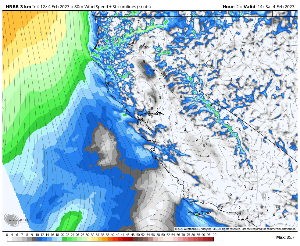
GFS 2 Day Base Wind
Today

Travel Map
Winter Storm Warnings go into effect tonight at 4 pm, as the system moves in from the southwest and will move through the Sierra, on a northeastern track, before turning due west around 2 am. Temperatures start out warm but will drop to the upper teens, to around 20 degrees overnight. Winds will be strongest, late today as the front approaches. Expect 50 mph gusts, which light up red on the wind map above, and quickly dissipate.
Sunday
Heavy snow throughout the day as operations could be affected by the storm, always check the resort website before you go to make sure they are open. Temperatures will stay around 20 throughout the day tomorrow. Winds will be strong, as usual for a storm like this. Base level gust in the 50 range with ridge top winds in the 80’s, so upper mountain lifts are likely a no-go. Monday will be a nice day to hit those spots.
Snow totals below are from yesterday. They are still looking pretty good, although I think the Mammoth totals are a little on the low end.
Next Storm Presidents Week


Utah,

 Today, will be a beautiful blue bird day with warm temperatures in the upper 30’s at base with light winds.
Tomorrow, the system moves in around 11 am, It will be pretty windy as the front approaches, expect winds to be between 20-30 mph with gusts around 45 mph. The heaviest snow will be between 2pm to midnight, but snow will continue thru Monday before the storm exits by lunchtime.
Monday, Snow in the morning and should wrap around noon. Light to moderate winds between 10-15 mph.
Colorado
 Storm arrives Sunday night and is weakening as it moves east. We have seen this many times before this season, and have been surprised by good totals, so I will continue to be optimistic that this storm will continue that trend. Generally, the models are predicting 2-4 across the board.
Those totals are in line with what happened last cycle, with Steamboat hauling in 4. We will dial in the totals tomorrow in hopes of improvement.
Thank you for reading the blog, as always, if you have any questions, or need personalized info for trip forecasts, please email me at Mike@FutureSnow.co
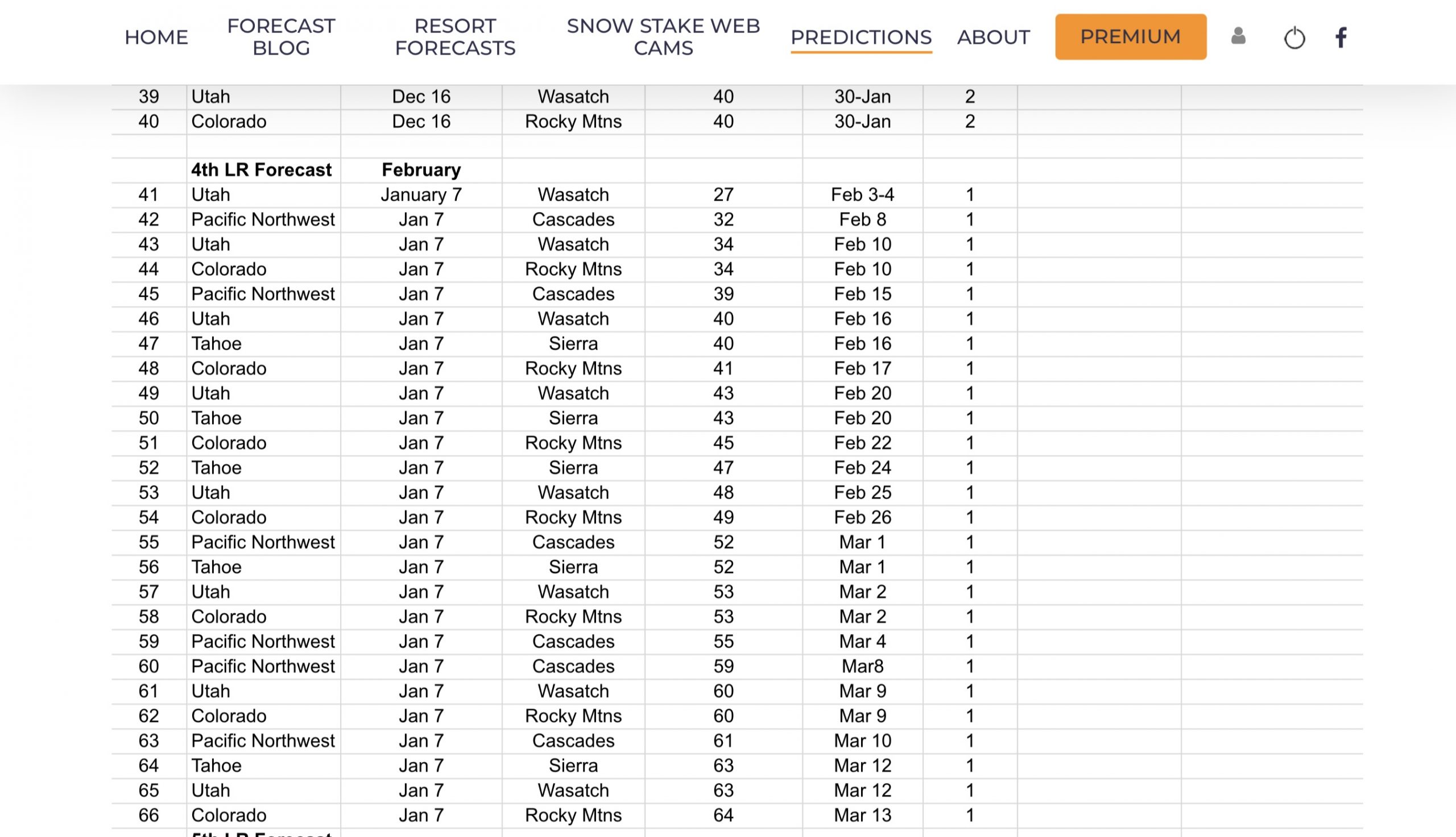
Long-Range Forecast Predictions thru March
 Forecasted Areas
Pacific Northwest Cascade Mountains
Crystal Mountain, Mount Hood Meadows, Timberline, 49 Degrees North, Bachelor, Mt Baker,
Lake Tahoe Sierra Mountains
Heavenly, Palisades Tahoe, Kirkwood, Dodge Ridge, Donner Ski Ranch
Utah Wasatch Mountains
Alta, Park City, Deer Valley, Brighton, Snowbird, Brian Head
Colorado Rocky Mountains
Aspen, Aspen Highlands, Snowmass, Vail, Beaver Creek, Winter Park, Keystone, Arapahoe Basin, Breckenridge, Copper Mountain, Powderhorn, Ski Cooper, Telluride, Crested Butte, Silverton, Wolf Creek, Eldora, Loveland
–
