
History of this Storm
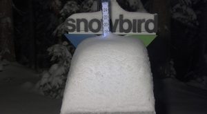
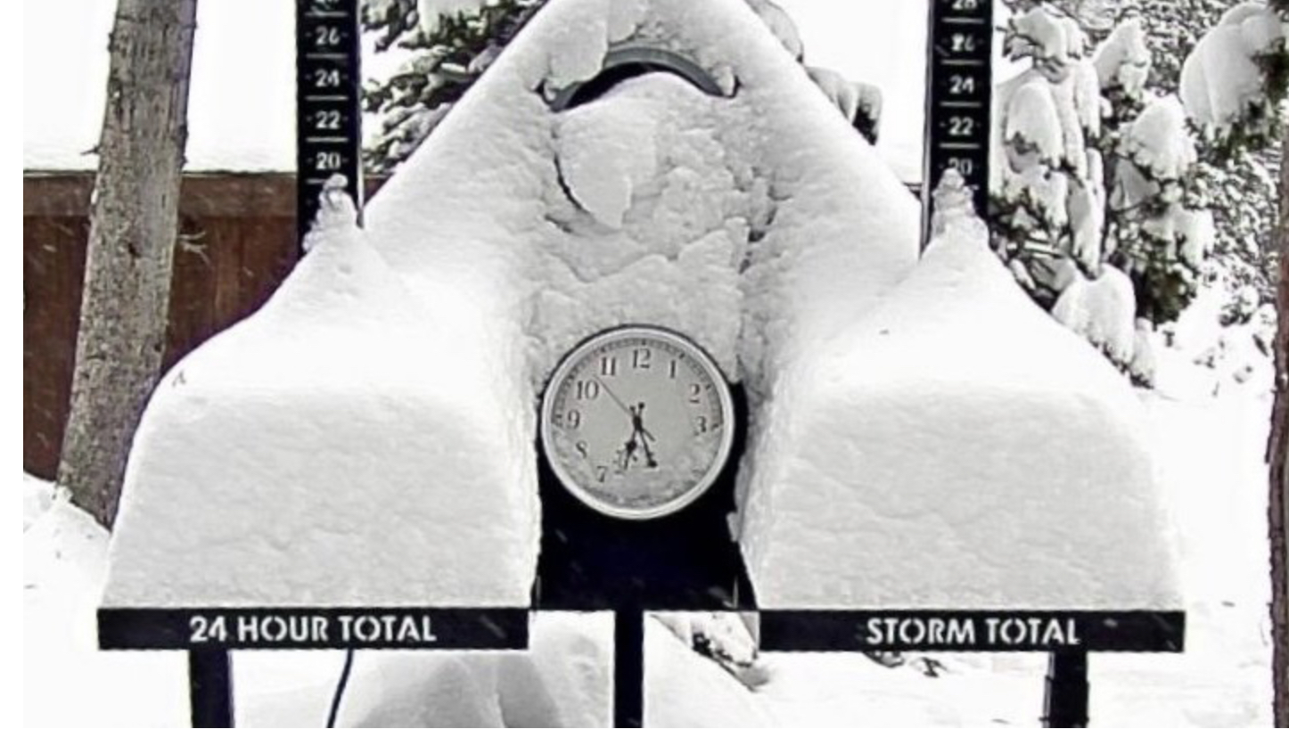
Well, here we go everybody, strap tight into your seats because winter moves into gear with the 3rd wave of the Trifecta. It arrived in the overnight hours, in Washington. The last time this storm came through, back in October, this was the largest producer, and it looks to definitely repeat. Utah resorts Alta had almost 30″ and Snowbird was right behind them. The Colorado resorts also took in a good haul with Vail 16″ and Wolf Creek, in the southern mountains receiving 17″. Montana’s Big Sky had 13″. We will have a brief storm recap on Monday before it’s on to the next storm. These two shots of snow stakes were from the last time through.
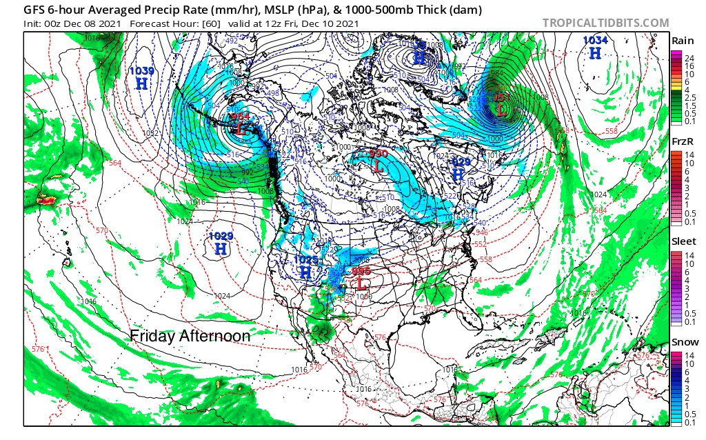
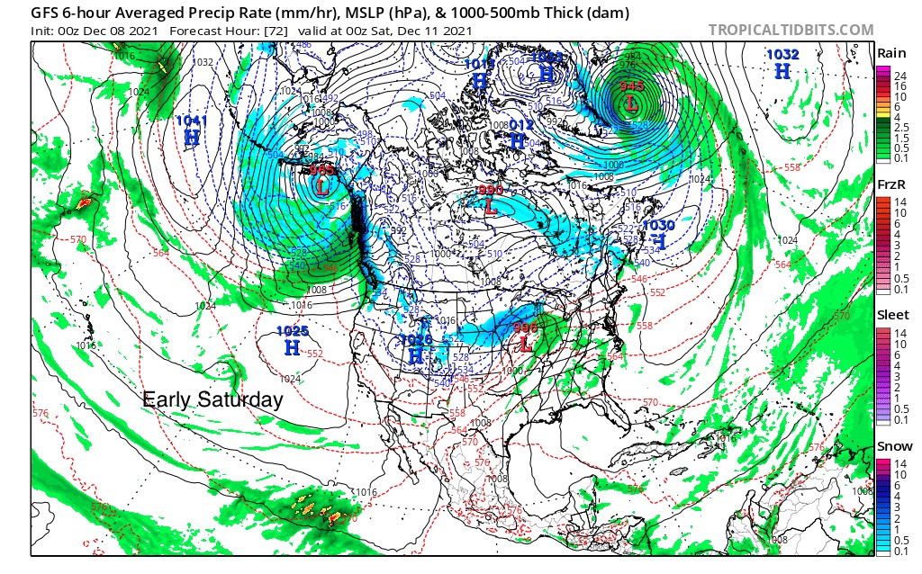
Thursday thru Saturday
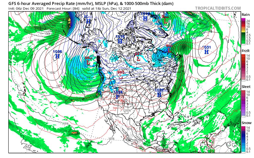
These next series of photos show the progression of the storm. Watch the next storm that is up off the Alaskan coast, in the Aleutian Islands. That storm will arrive Sunday night/Monday. That is our next possible atmospheric river (AR) event for California. That storm is detailed in the next section. But first the present system.
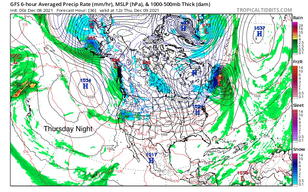
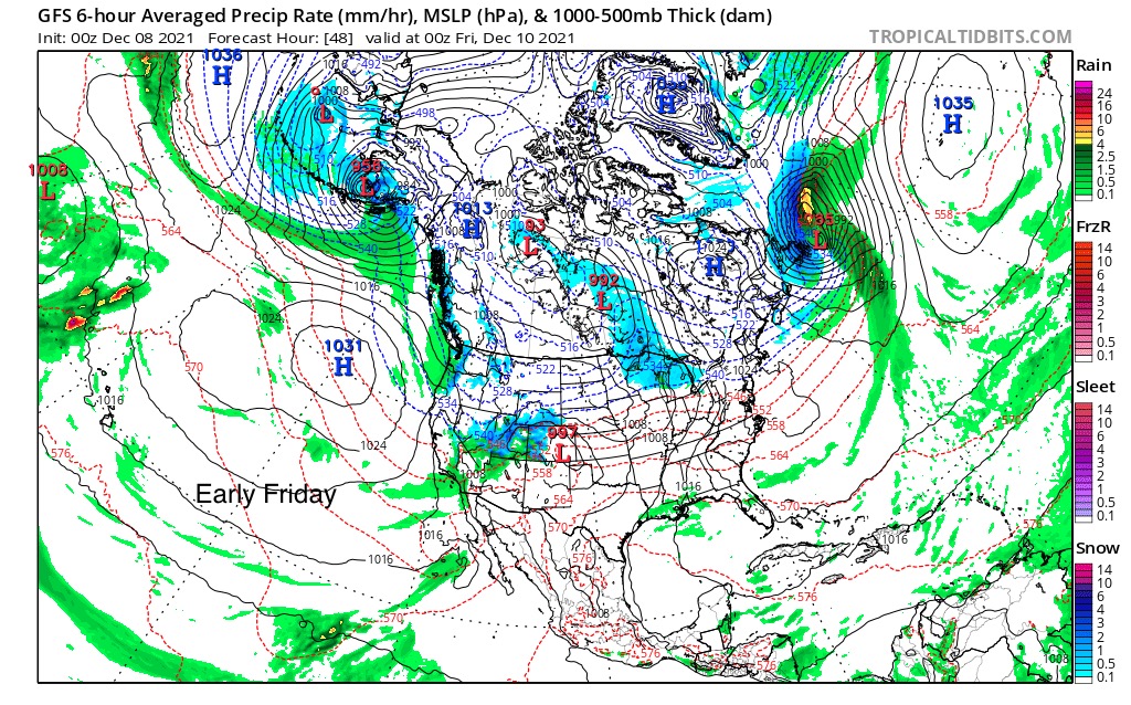
Next are the 3-day projected totals. Those are some large numbers for the Pacific Northwest.
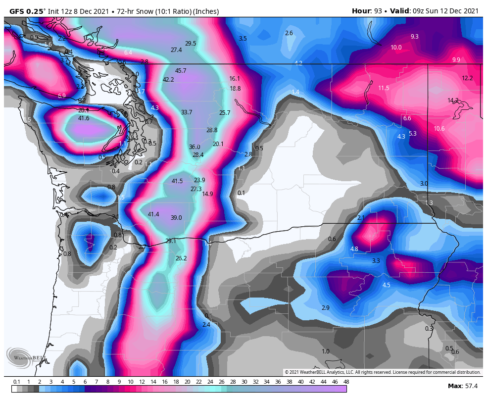
Washington and Oregon 3-Day Snow Totals
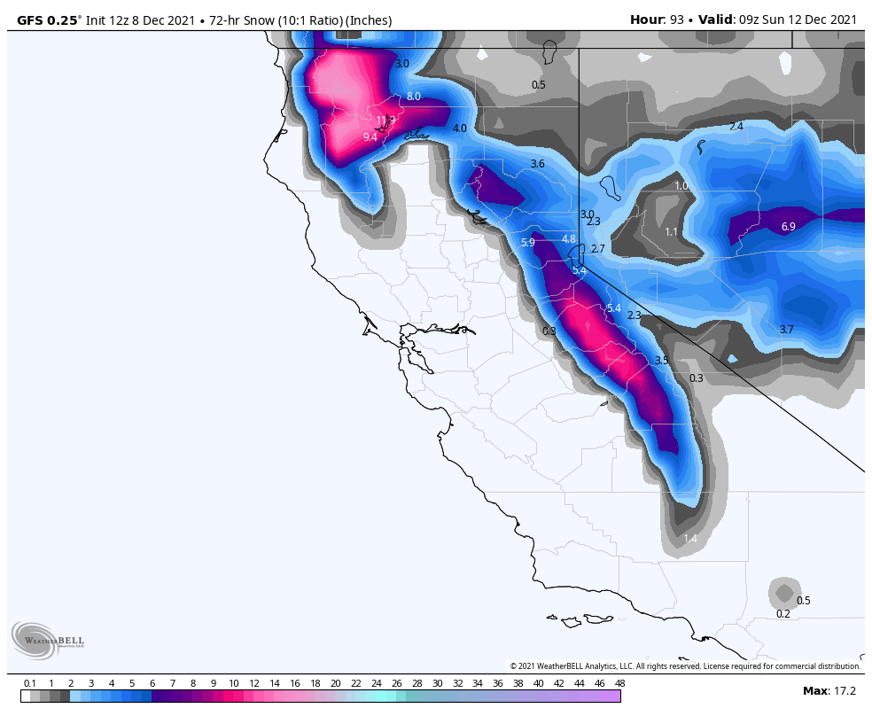
California and Nevada 3-Day Storm Totals
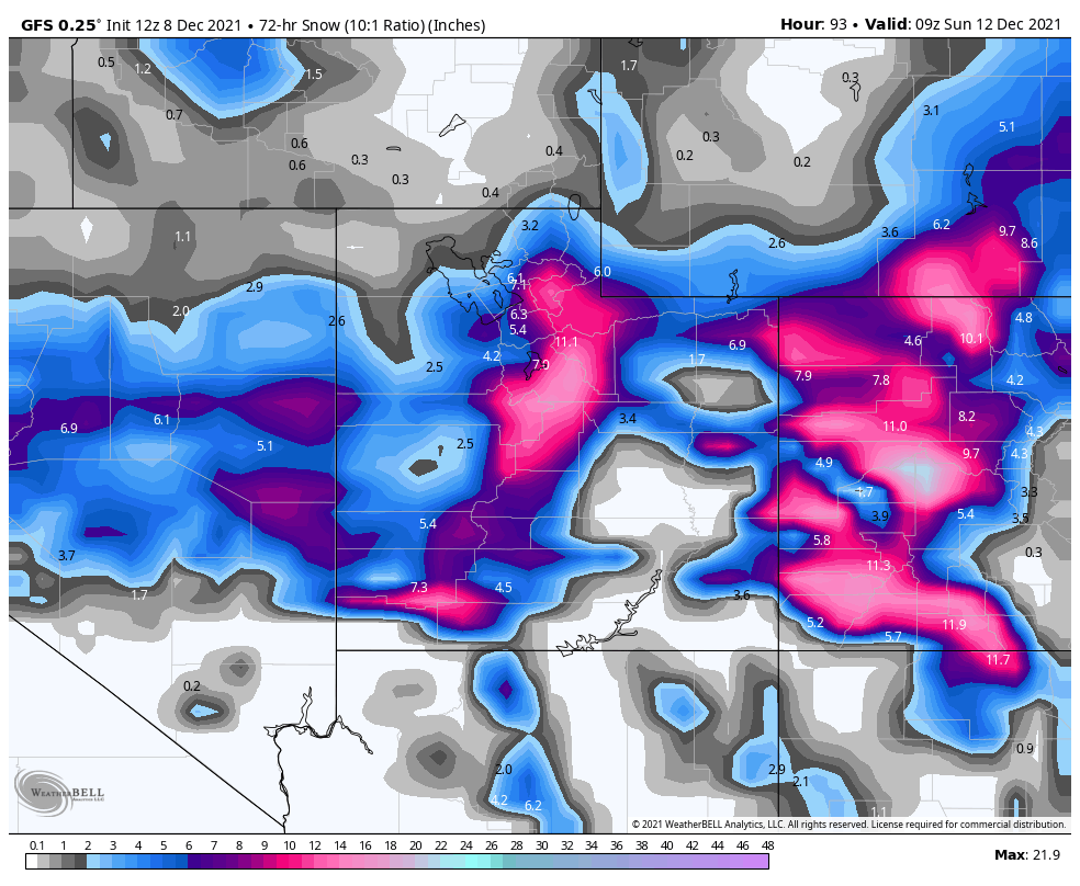
Utah and Colorado 3-Day Storm Totals
So that is the history of this final wave of the Trifecta. It will return again in early February. After the Trifecta storm comes through, a unique system will follow. I say unique, because of the storm track. It takes a U shape like path that makes it stick out. Let’s call it the U Storm. So here it is, in a short video with the last time through in October to the projected GFS track.
Monday Dec 13th U-Storm
A couple of things you should watch for. First, the projected storm is on the left. Next, the projected storm is much larger due to the stronger jet. The Jet Stream will continue to get stronger for the next several weeks. Watch how the storm follows the same path it took in October. This storm will return in early February.
This is setting up similar to the AR event back in October. Let’s keep an eye on this next system and see how it sets up.
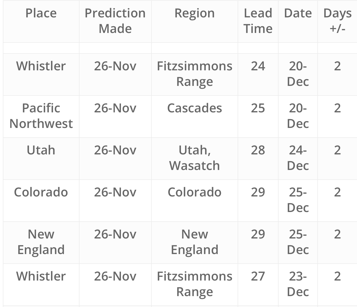
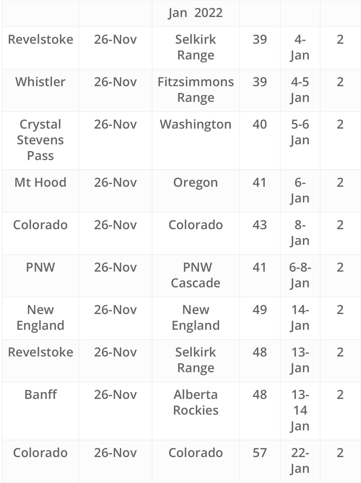
Future Snow Dates
Thanks for reading the blog. If you have any questions or comments, feel free to comment below or send me an email to Mike@FutureSnow.co
