Posted November 8, 2023


Lake Effect Enhancement
Forecast Discussion


Click to Animate
Utah Recap
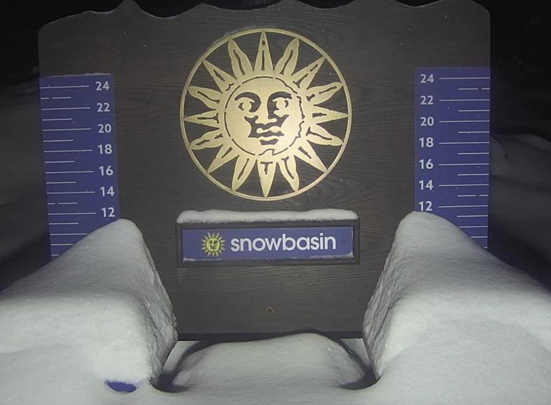
Decent totals in Utah this morning as the system has come through and is working its way through Colorado. A little lake effect enhancement for Snowbasin as they have about 9 inches on their stake. Snowbird looks to be at 7, Alta 4, Deer Valley 8. Brian Head, which is much further south, looks to have around 2.
Colorado
 Snow is falling and temperatures are on the warm side, so lower elevations will not do well. The central and northern mountains are again the sweet spot for this storm. Vail, Beaver Creek and Aspen should do well and be in the 6-10 range. I think one of those resorts will get a 10 spot. The Divide resorts Arapahoe Basin and Loveland should be in the 4-8 range. Eldora had 3 on their stake this morning, with another 3-6 coming. They might be the winner by tomorrow morning.
A bit of news from Arapahoe Basin, they have opened their uphill access today. Stop and get an uphill pass before you go, they have restrictions to non-operating hours, with High Noon trail open so far.
Long Range Forecast
Below is the latest map showing model guidance through 270 hours (11.25 days).

You can see the northern pattern feeding the Pacific Northwest all the way up to Alyeska Alaska. Alyeska is right in the middle of the bend of the Gulf–right at the bottom of the border line from Canada/Alaska.

Alyeska Ski Resort
Alyeska is a great resort with huge steeps, but plenty of blue and green runs for the whole family. February and March are a good time to go due to the amount of daylight. They have limited hours of daylight, so December and January operating hours are short. On the plus side, the Aurora is incredible on a clear night.
We have come thru with the first long-range prediction. The second prediction is on the GFS above. The timing was a day early for the first storm. These predictions are based on an assumption of the cycle length. If all of the predicted storms come a day early, then we would adjust the cycle length.
Normal variability of storm systems is between 1-3 days, when we get into the second cycle, we adjust our varibility to +/- 1 day. That is a little risky due to the natural fluctuations in the storm track. If a storm is 2 days late we are wrong on the prediction chart. I feel the +/- 1 day is necessary though, because 2 days is a 4-day swing and I think it is important to be credible and for trip planning.
Ski Concierge Service
As a member of FutureSnow, you have access to our Ski Concierge Service. Simply email us your trip date and time range and we will tell you when and where go. Along with personalized forecasts for your trip.
Last year, we had a select group meet us at Alta for a huge storm that we saw coming months in advance. We skied deep powder everyday with dumps of 11, 11, 19, and 7. We will plan a trip again this year once we know when and where the best snow will be.
Test Predictions +/- 2 Days
Nov 9th Colorado Verified 1-Day Early
Nov 17th PNW
Nov 18th Utah
Nov 19th Colorado
Nov 22nd Tahoe (maybe)
Nov 23rd Utah
Nov 24th Colorado
Nov 27th Tahoe
Nov 28th Utah
Nov 29th Colorado
Hurricane Page
We accurately predicted 3 hurricanes this year. Hilary, Idalia, and Lidia. All three storms had the correct date and location, within 1 day of the predicted date. Hilary and Idalia had the predicted path.
The season is almost over but there might be one more. There is a possibility around November 17th that is showing up on the models around Cuba in the Caribbean Sea.
You can find the original post May 19th, and all Hurricane posts on this page—most recent posts appear first. https://futuresnow.co/hurricane-forecast-2023/
Thanks for reading the blog! If you have any questions, feel free to comment below or email me at Mike@FutureSnow.co
