Summary
Northern part of the pattern for the next 13 days–less than 2 weeks left. It’s been brutal, this feast or famine pattern. That just tells you to take advantage when the Active West Pattern returns, and the skiing is good. So, line up your sick days, vacation days, PTO for those dates in February.
A small wave is moving from the PNW, to Colorado, on a line. There is not much moisture in this system, you can see how paltry it is in this animation from our good neighbors to the north. Watch the clouds as they move over the mountain passes, you can see how they catch the snow, and how the moisture pours over the other side of the Crest.
I like to use Canadian weather resources during the Northern Pattern. Lucky Canada, they are getting plenty of moisture, during both patterns, but probably wouldn’t complain if it was dry, eh?
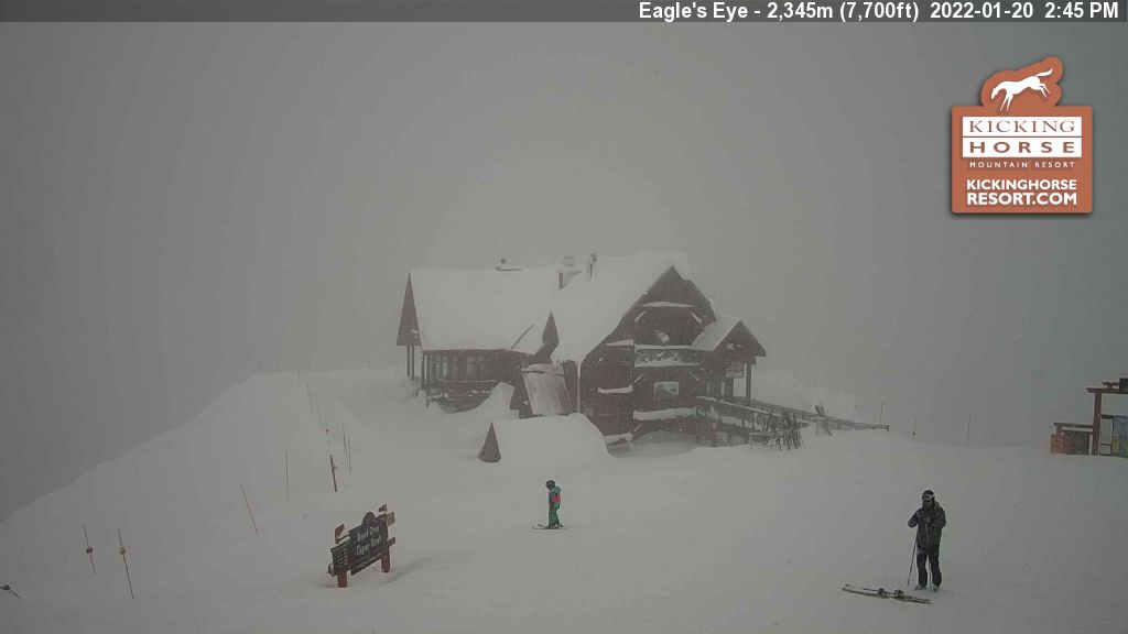
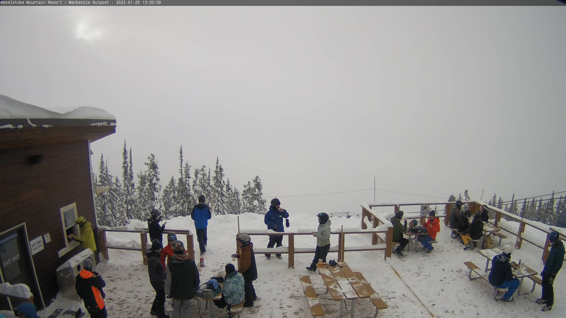
Canadian Stoke
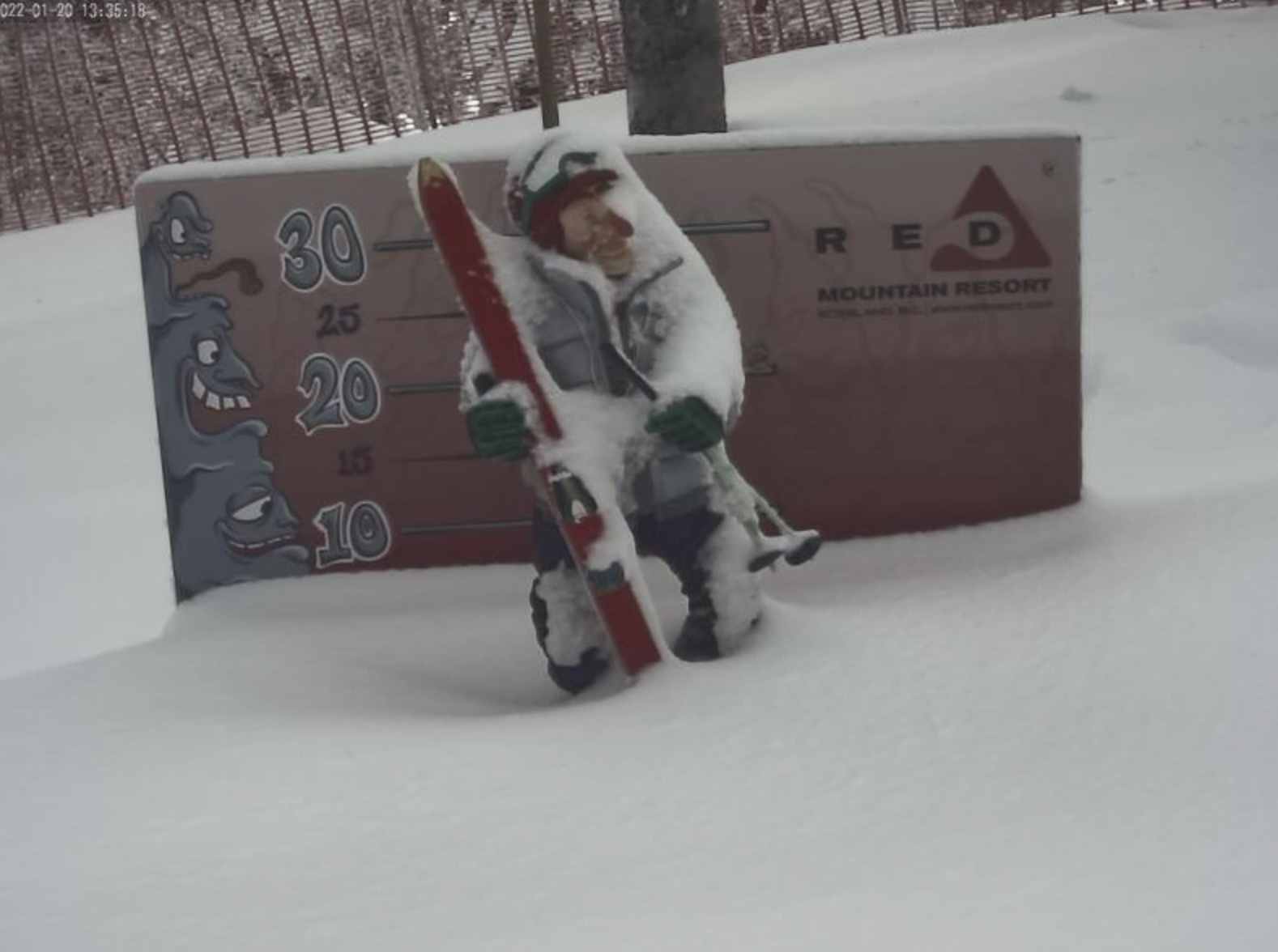
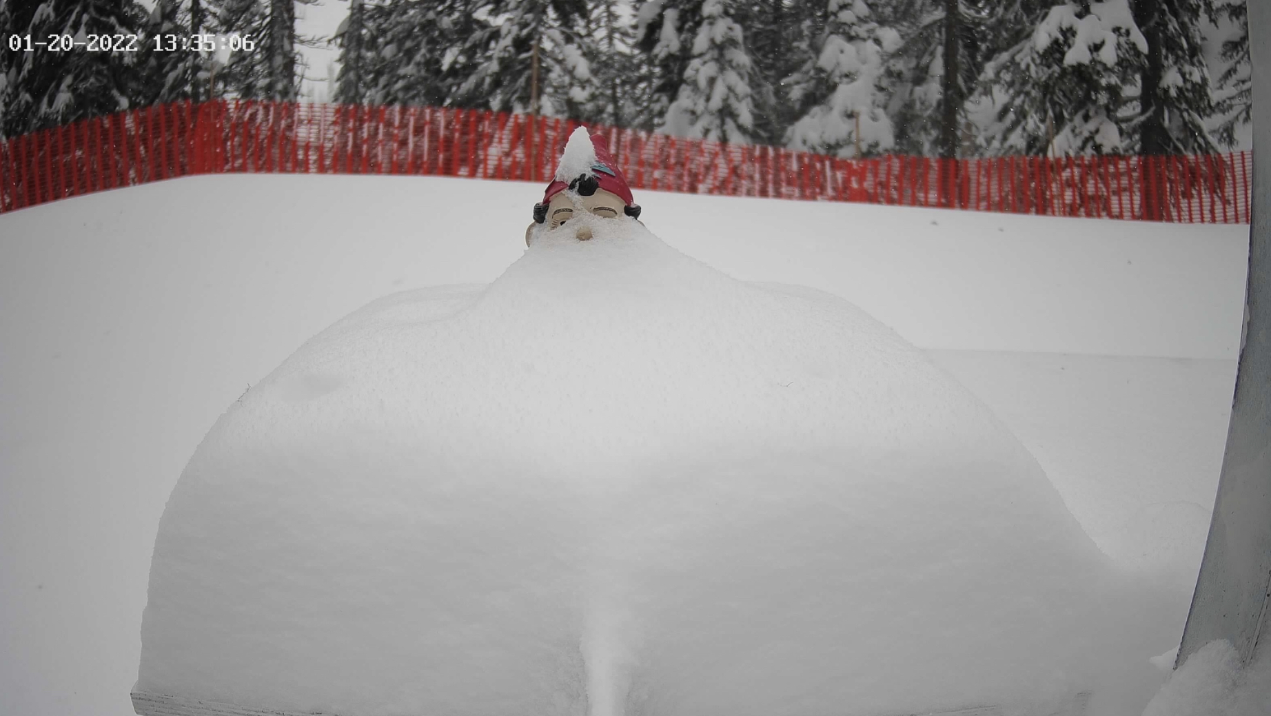
American Stoke


Forecast

Utah
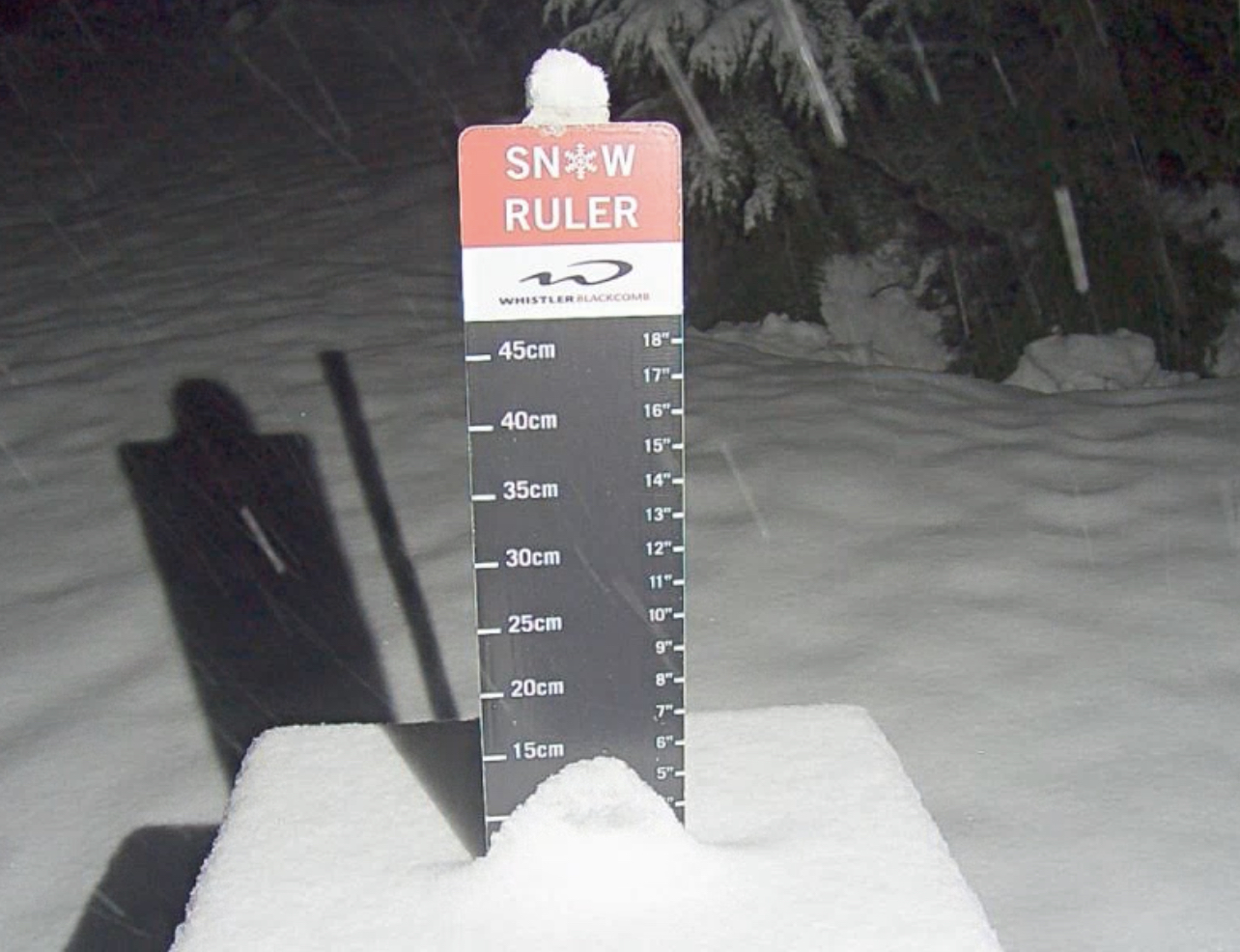
After a decent night with a few inches for most mountains, snow will continue this morning and exit around lunch. This is quite a welcome refresh, as we have only a couple of systems left of the Northern Pattern before the switch in patterns. Expect a couple more today, light winds with highs in the low 20’s. Bluebird skies for the rest of the weekend with similar temps and wind. Next system Tuesday.
Colorado
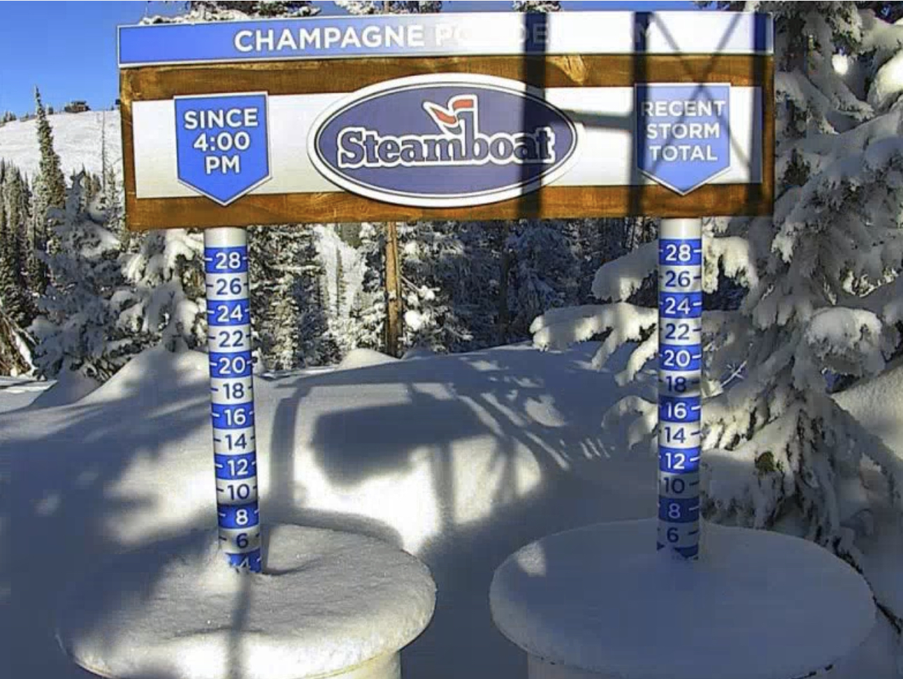
The small system moved in overnight. Some areas have picked up a few of inches from overnight, see Steamboat above. A few more inches for most of Colorado today. Mild temps after the storm moves through with highs the rest of the week around 30 with light winds.
Snow Concierge/Presidents’ Day Forecast

Presidents Day is February 21st and we have been getting a lot of requests for things like, where to go? To, what is the forecast for Vail? We have a new service for these kinds of requests, we call it our Snow Concierge Service. With our Snow Concierge Service, you get a personal forecast for your destination. Or, if you’re not sure where to go, let us guide you to where the snow will be falling the week of your vacation.
Just send an email to Mike@FutureSnow.co with your vacation date, and destination, and we will give you the latest info and personal forecast. The best part is, it’s free.
Presidents’ Day Weekend
Colorado and Utah
Presidents’ Day falls during the Active West Pattern so there are a lot of choices for this holiday. The Trifecta is due before the holiday, so it should have a great kick start before the week leading up to Presidents’ Day. We will start at Valentine’s Day, and progress thru the week (pattern days 19-26). On days 19-20 in cycle 1, both Colorado and Utah resorts had snow with Alta having the most 11. In Cycle 2 Days 19-20, Alta wins again with 23. Colorado ranged from 5-12 with Steamboat the winner.
In both cycles days 21-23 had no snow. That gets us to days 24-26. Cycle 1: Utah, again the winner with Alta having 4-day totals of 21″. Colorado totals were minor 4-8. Cycle 2: Alta and Snowbird both with 20. Colorados Wolf Mountain had 14 and 12 and Aspen had 12.
Tahoe
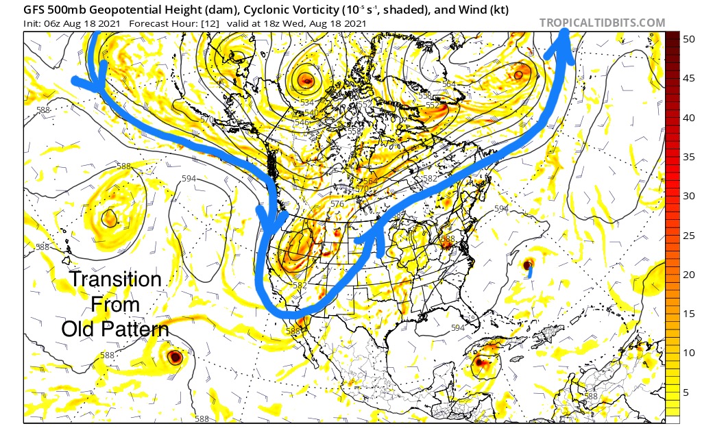
Tahoe is a little trickier. Back in August and September, as the transition from last year’s pattern to this year’s, the storm path was mainly in Canada. However, there was one storm that stuck out as completely new. That storm hit August 18th and just grazed Lake Tahoe.
 As a forecaster, you have to project how far south the storms will track as the jet stream lowers. Tahoe, I thought, was on the edge of the storms, based on that one back in August. In Cycle 1, Palisades Tahoe reported 8 on October 18th. but it was mostly a warm storm. Cycle 2, all of the elements came together for a huge storm dumping 75 inches in 5 days. That was the third wave of the Trifecta, and that storm wraps on day 19. In both cycles days 20-24 were dry.
Day 25. This was the Christmas Eve storm in Cycle 2, that we predicted based on what happened in cycle 1, October 25th–Tahoe 39 at Palisades. In cycle 2, day 25 kicked off a 9-day torrent of relentless snow that shut down and buried the resorts with 130 inches.
Pacific Northwest
October, in the Cascades, was warm and wet in the first Cycle, days 19-26, the only precipitation that was snow was reported at Mt Hood and Whistler Blackcomb (25-26). Cycle 2, it snowed 5 of the 7 days and Mt Hood Meadows received around 50 inches.
Rank ’em
If you haven’t picked your destination, you can’t really go wrong. Cycle 3 should be around the same strength as cycle 2. The storms have been trending late, however the lead-in storm, the Trifecta would just linger a day, or so, longer. There will be good snow everywhere, barring the unforeseen.
There are pros and cons to each destination. Will it be warm for resorts like Mt Rose, Donner Ski Ranch and Palisades in the Tahoe region? Same can be said for Crystal Mountain, Mt Hood and Stevens Pass. Utah and Colorado will most likely be colder. My choice is Utah, I will be at Alta, Snowbird and Park City, based on the best chance for quality of snow.
