
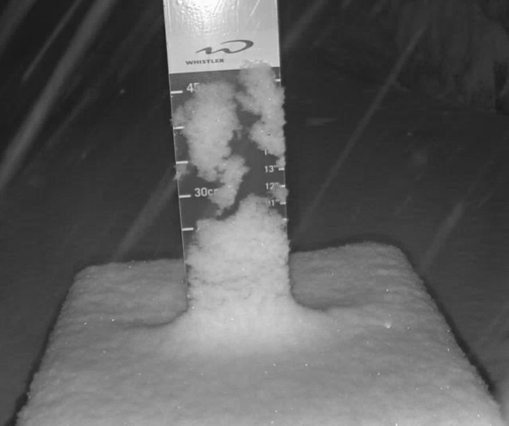
Daily Snow Stakes
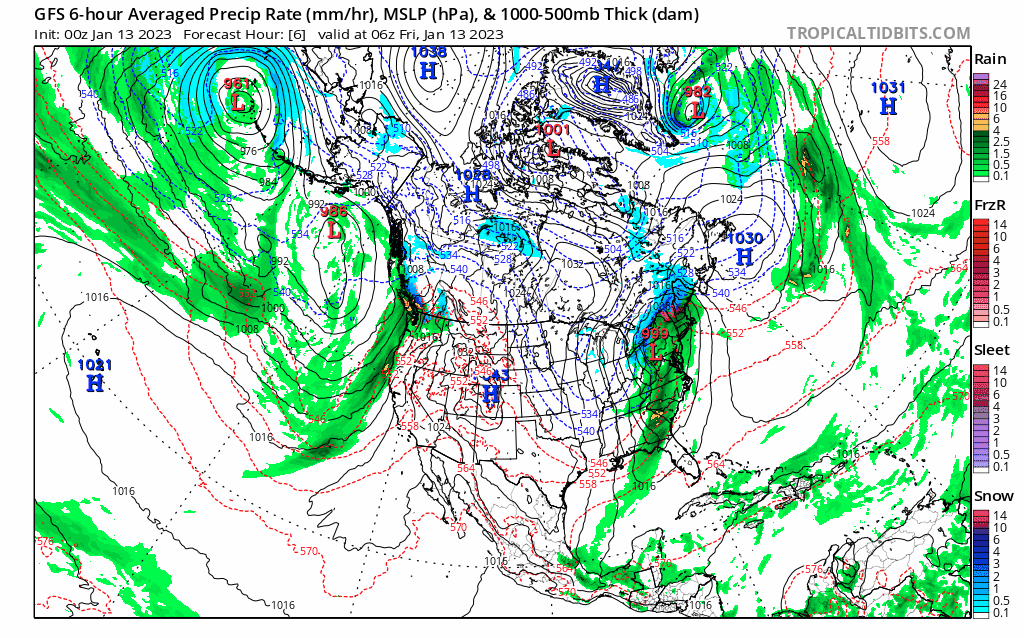 Forecast Summary
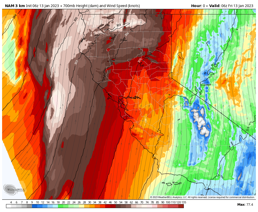
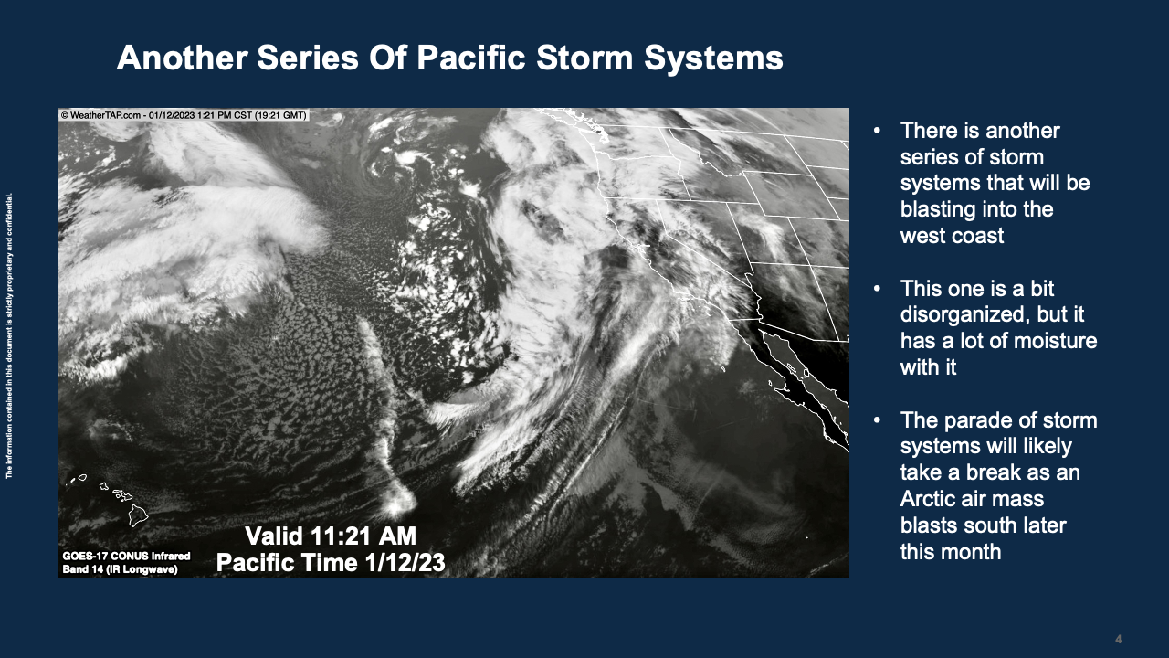
The first storm of this week’s Trifecta begins this morning, as the storms continue to churn towards the Sierra, in the Pacific and Bering Sea. Winter Storm Warnings expected thru MLK day for the Sierra, as these three systems will be measured in feet. The highest amounts will likely be in the 4-6 feet range, for Kirkwood. On the lighter side, Sierra at Tahoe in the 2-3 feet range. Let’s watch how it plays out.
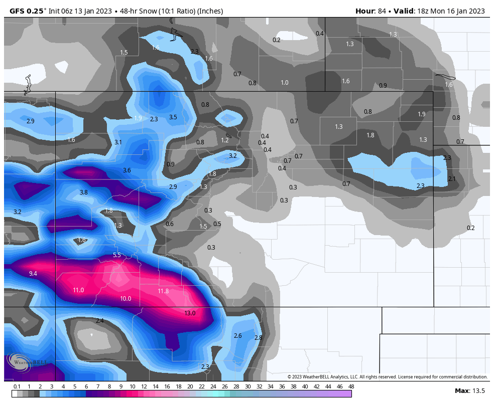
The storm reaches Utah resorts Saturday night. I don’t think the models have a solid grasp on the totals yet, as there is quite a difference between them. Generally, they are saying around 6-12 for the usual hot spots, but I think it’ll be a little higher based on the last time through–Alta 18 and Snowbird 15.
Colorado hits early Sunday morning to around noon. Presently, the models predict the bullseye to be in the San Juans, with an 8-12 range, with 5-8 for the central mountains, and 2-4 for the northern mountains. The last time through it was the opposite, with the northern mountains of Aspen, Beaver Creek and Vail all receiving 11, while Telluride and Wolf Creek had 4.
The southern track makes since with the stronger jet stream this time of year, so I’m with the models on this one, although I do think the northern mountains will have higher amounts.

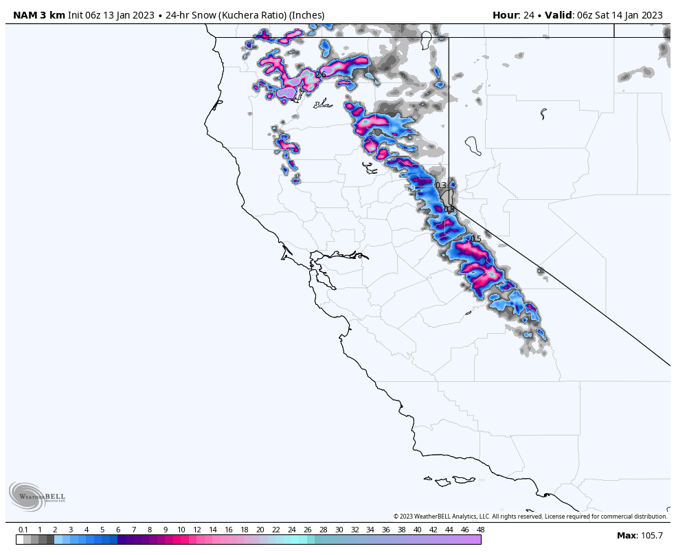
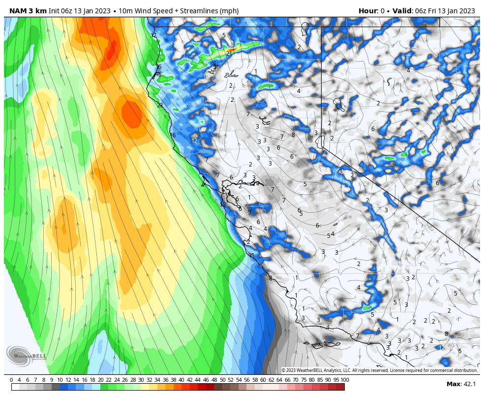
Tahoe
Wind Speed (Click to Animate)
Base Level Winds
Ridge Top Winds
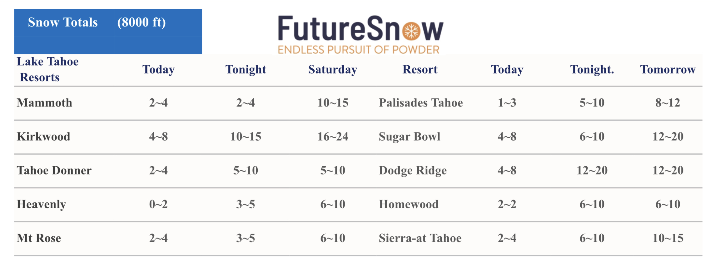
The storm arrives around 10 this morning with strong winds as the front approaches. The highest amounts today will be in the central Sierra. Temperatures will be in the low 30’s at base level and are expected to fall during the day.
Tomorrow: Temperatures in the mid 20’s at base level, with strong winds with base level gusts in the 50’s and ridge top winds near 100 mph. Upper mountain closures likely. Expect heavy snow throughout the day and evening.
Sunday: Winds calm down and so does the snowfall rates. This is the day to get on the hill, with cold temperatures, around 25 at base, with moderate winds in the 15-20 mph range.
MLK Day: The next round fires up with heavy snowfall expected throughout the day. Temperatures will be in the mid 20’s with strong winds in the 25-35 mph range likely at base level with 50+ at upper mountain areas.
 Utah
Utah
2-Day Storm Total Below
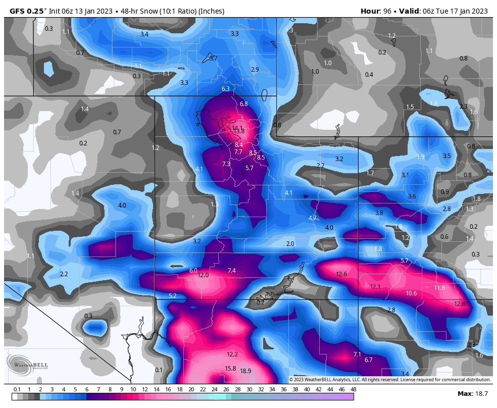
Colorado
2-Day Storm Total Below
Long-Range Predictions thru March (from Monday)
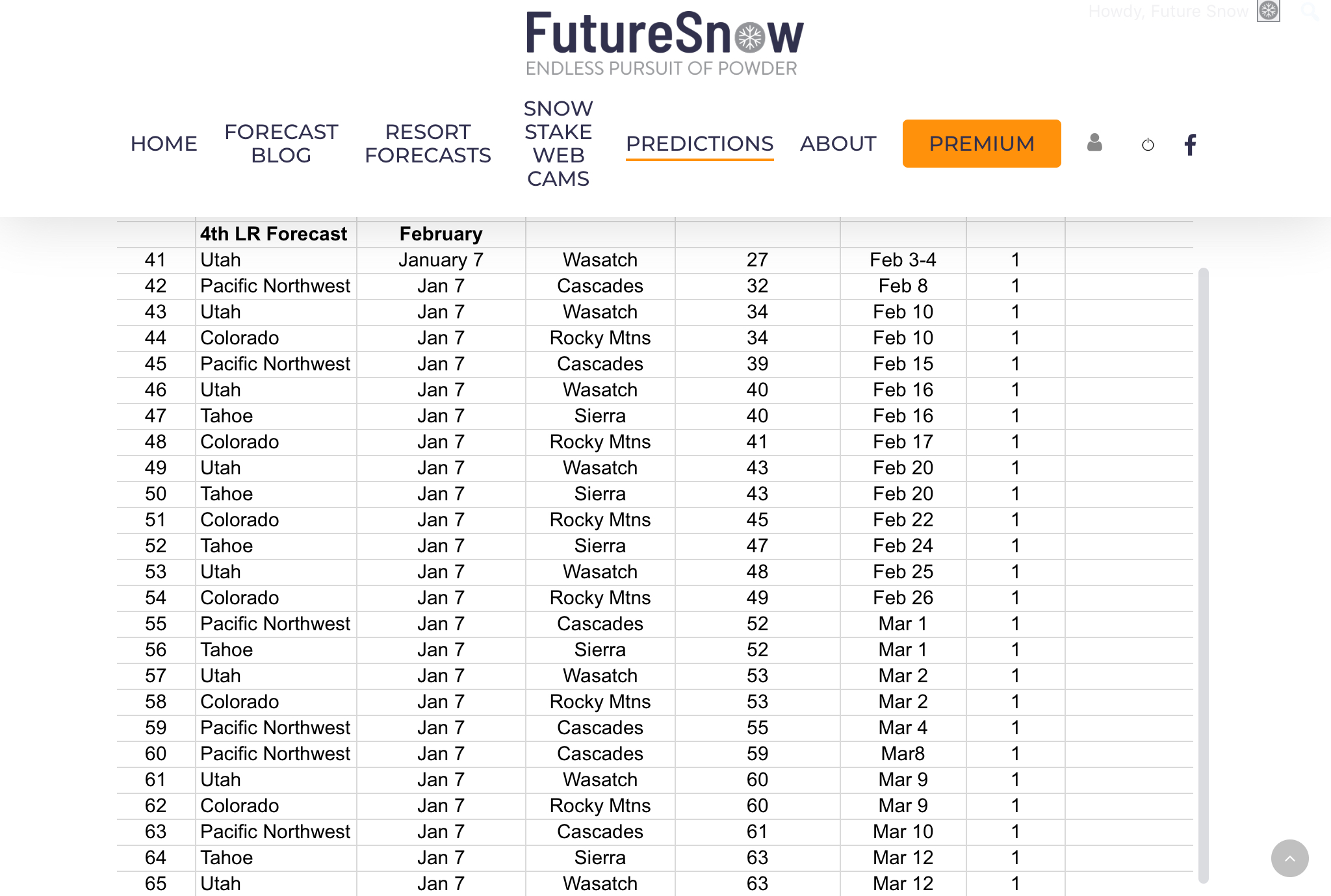 We have our long-range forecast out thru March, there have been a lot of emails regarding the long-range, and I thank you for your patience. Every year, it is very challenging to put all of this together.
We are getting better and better at figuring out the cycle, what the various teleconnections are, and how likely they are to affect the pattern. It’s a lot of calculating, analyzing charts, and waiting.
It is also very rewarding once you figure out what is going on. Sometimes you think you have it all figured out, only to realize you were wrong. It takes all of the aforementioned process and much more, that I won’t bore you with, but there it is.
As always you can email me with other resorts and areas you are interested in. We can forecast for the entire northern hemisphere, so if you are interested in the east coast resorts, Europe, or Canada, just let us know and we will give you a detailed forecast.
Forecasted Areas
Pacific Northwest Cascade Mountains
Crystal Mountain, Mount Hood Meadows, Timberline, 49 Degrees North, Bachelor, Mt Baker,
Lake Tahoe Sierra Mountains
Heavenly, Palisades Tahoe, Kirkwood, Dodge Ridge, Donner Ski Ranch
Utah Wasatch Mountains
Alta, Park City, Deer Valley, Brighton, Snowbird, Brian Head
Colorado Rocky Mountains
Aspen, Aspen Highlands, Snowmass, Vail, Beaver Creek, Winter Park, Keystone, Arapahoe Basin, Breckenridge, Copper Mountain, Powderhorn, Ski Cooper, Telluride, Crested Butte, Silverton, Wolf Creek, Eldora, Loveland
